
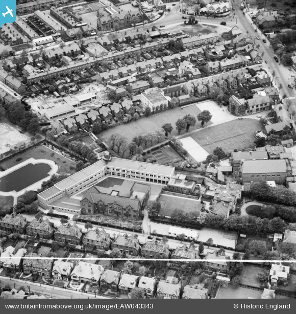
EAW043343 ENGLAND (1952). St Mary's College and environs, Great Crosby, 1952. This image was marked by Aerofilms Ltd for photo editing
© Hawlfraint cyfranwyr OpenStreetMap a thrwyddedwyd gan yr OpenStreetMap Foundation. 2026. Trwyddedir y gartograffeg fel CC BY-SA.
Delweddau cyfagos (6)
EAW043343

EAW043345

EAW043347

EAW043344

EAW043342

EAW043346

Manylion
| Pennawd | [EAW043343] St Mary's College and environs, Great Crosby, 1952. This image was marked by Aerofilms Ltd for photo editing |
| Cyfeirnod | EAW043343 |
| Dyddiad | 16-May-1952 |
| Dolen | |
| Enw lle | GREAT CROSBY |
| Plwyf | |
| Ardal | |
| Gwlad | ENGLAND |
| Dwyreiniad / Gogleddiad | 332024, 399640 |
| Hydred / Lledred | -3.0246218027491, 53.488824023138 |
| Cyfeirnod Grid Cenedlaethol | SJ320996 |
Pinnau

rivermersey |
Monday 24th of March 2025 08:08:49 PM | |
|
rivermersey |
Friday 29th of May 2020 11:06:58 AM |