
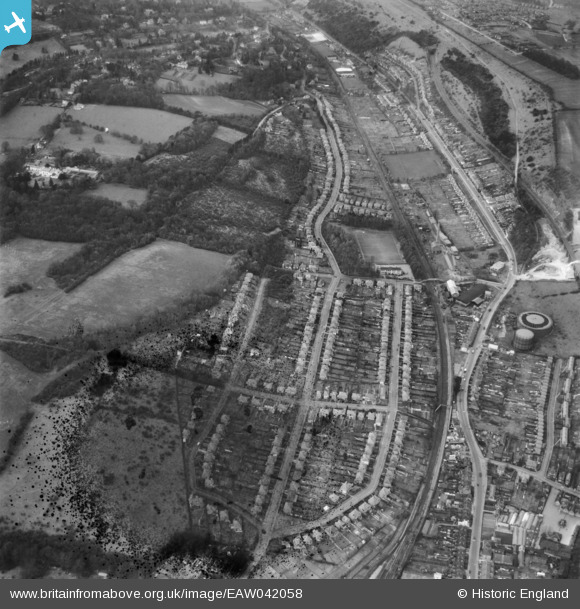
EAW042058 ENGLAND (1952). Housing off Valley Road and Beverley Road, Kenly, 1952. This image has been produced from a damaged negative.
© Hawlfraint cyfranwyr OpenStreetMap a thrwyddedwyd gan yr OpenStreetMap Foundation. 2026. Trwyddedir y gartograffeg fel CC BY-SA.
Delweddau cyfagos (3)
EAW042058

EAW042060

EAW042059

Manylion
| Pennawd | [EAW042058] Housing off Valley Road and Beverley Road, Kenly, 1952. This image has been produced from a damaged negative. |
| Cyfeirnod | EAW042058 |
| Dyddiad | March-1952 |
| Dolen | |
| Enw lle | KENLEY |
| Plwyf | |
| Ardal | |
| Gwlad | ENGLAND |
| Dwyreiniad / Gogleddiad | 533412, 158968 |
| Hydred / Lledred | -0.085524464028352, 51.313657522251 |
| Cyfeirnod Grid Cenedlaethol | TQ334590 |
Pinnau

Tony74 |
Saturday 31st of May 2025 07:40:41 PM | |
|
Tony74 |
Saturday 31st of May 2025 07:38:22 PM | |
|
Tony74 |
Saturday 11th of October 2014 02:27:15 PM | |
|
Tony74 |
Saturday 11th of October 2014 02:26:50 PM | |
|
Tony74 |
Saturday 11th of October 2014 02:26:25 PM | |
|
Tony74 |
Saturday 11th of October 2014 02:25:36 PM | |
|
Tony74 |
Monday 6th of October 2014 04:55:19 PM | |
|
Tony74 |
Monday 6th of October 2014 04:52:50 PM | |
|
Tony74 |
Monday 6th of October 2014 04:51:29 PM | |
|
Tony74 |
Monday 6th of October 2014 04:49:22 PM | |
|
Tony74 |
Monday 6th of October 2014 04:46:56 PM | |
|
Wrinkly |
Sunday 28th of September 2014 02:32:22 AM | |
|
Wrinkly |
Sunday 28th of September 2014 02:30:37 AM |