
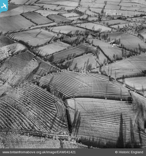
EAW041421 ENGLAND (1951). Ridge and Furrow in fields east of Moreton Pinkney, 1951. This image has been produced from a damaged negative.
© Hawlfraint cyfranwyr OpenStreetMap a thrwyddedwyd gan yr OpenStreetMap Foundation. 2026. Trwyddedir y gartograffeg fel CC BY-SA.
Delweddau cyfagos (2)
EAW041421

EAW041422

Manylion
| Pennawd | [EAW041421] Ridge and Furrow in fields east of Moreton Pinkney, 1951. This image has been produced from a damaged negative. |
| Cyfeirnod | EAW041421 |
| Dyddiad | 6-December-1951 |
| Dolen | |
| Enw lle | MORETON PINKNEY |
| Plwyf | MORETON PINKNEY |
| Ardal | |
| Gwlad | ENGLAND |
| Dwyreiniad / Gogleddiad | 458488, 249339 |
| Hydred / Lledred | -1.1452966452395, 52.138838409576 |
| Cyfeirnod Grid Cenedlaethol | SP585493 |
Pinnau

Maurice |
Monday 29th of December 2014 07:18:24 PM | |

Dave Brunt |
Monday 29th of December 2014 06:51:19 PM | |
|
Dave Brunt |
Monday 29th of December 2014 06:50:48 PM | |

Class31 |
Monday 28th of April 2014 10:44:04 AM | |
Stratford-upon-Avon and Midland Junction Railway |
Dave Brunt |
Monday 29th of December 2014 06:50:12 PM |
Cyfraniadau Grŵp
Very well-developed ridge and furrow field systems. These should be easily identified by an expert in the history of r&f! (Maybe Leicestershire, a wild hunch ...) |
Rebecca |
Thursday 11th of December 2014 11:33:54 AM |
Both images show same fields, EAW041421 EAW041422 |
TomRobin |
Monday 14th of July 2014 07:02:04 PM |