
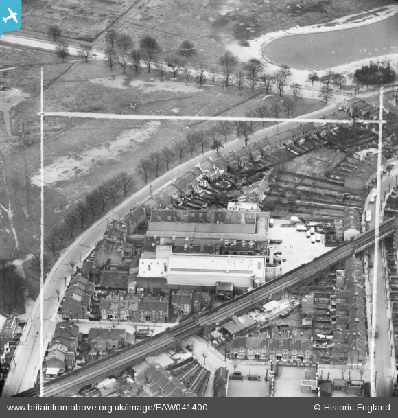
EAW041400 ENGLAND (1951). The H. W. Nevill Ltd Bakery off Harrow Road, Leytonstone, 1951. This image was marked by Aerofilms Ltd for photo editing.
© Hawlfraint cyfranwyr OpenStreetMap a thrwyddedwyd gan yr OpenStreetMap Foundation. 2026. Trwyddedir y gartograffeg fel CC BY-SA.
Delweddau cyfagos (13)
EAW041400

EAW041398

EAW041397

EAW041399

EAW041395

EAW041396

EAW041405

EAW041402

EAW041394

EAW041403

EAW041401
 off Harrow Road, Leytonstone, 1951. This image has been produced from a damaged negative.")
EAW041404

EPW026951

Manylion
| Pennawd | [EAW041400] The H. W. Nevill Ltd Bakery off Harrow Road, Leytonstone, 1951. This image was marked by Aerofilms Ltd for photo editing. |
| Cyfeirnod | EAW041400 |
| Dyddiad | 22-November-1951 |
| Dolen | |
| Enw lle | LEYTONSTONE |
| Plwyf | |
| Ardal | |
| Gwlad | ENGLAND |
| Dwyreiniad / Gogleddiad | 539877, 186367 |
| Hydred / Lledred | 0.018014097479378, 51.558341032068 |
| Cyfeirnod Grid Cenedlaethol | TQ399864 |
Pinnau

Roger |
Thursday 26th of January 2023 12:37:17 AM | |
|
Hermann the German |
Tuesday 5th of September 2017 08:41:10 PM | |
|
Hermann the German |
Tuesday 5th of September 2017 08:40:19 PM | |
|
Hermann the German |
Tuesday 5th of September 2017 08:19:48 PM | |
|
Hermann the German |
Tuesday 5th of September 2017 08:17:38 PM |