
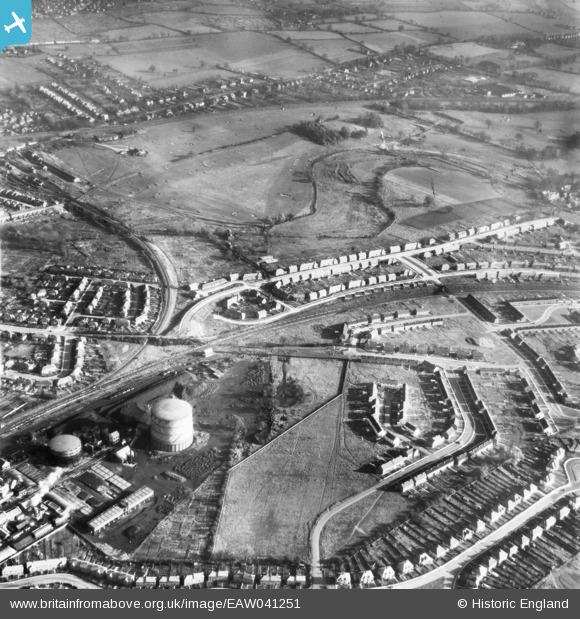
EAW041251 ENGLAND (1951). The Gas Works and development of housing at Maynard Drive and Berners Drive, Sopwell, 1951
© Hawlfraint cyfranwyr OpenStreetMap a thrwyddedwyd gan yr OpenStreetMap Foundation. 2026. Trwyddedir y gartograffeg fel CC BY-SA.
Delweddau cyfagos (3)
EAW041251

EAW030953

EAW030951

Manylion
| Pennawd | [EAW041251] The Gas Works and development of housing at Maynard Drive and Berners Drive, Sopwell, 1951 |
| Cyfeirnod | EAW041251 |
| Dyddiad | 14-November-1951 |
| Dolen | |
| Enw lle | SOPWELL |
| Plwyf | |
| Ardal | |
| Gwlad | ENGLAND |
| Dwyreiniad / Gogleddiad | 515057, 205958 |
| Hydred / Lledred | -0.3334392783479, 51.740044739544 |
| Cyfeirnod Grid Cenedlaethol | TL151060 |
Pinnau

Sandyn |
Saturday 21st of August 2021 04:57:07 PM |