
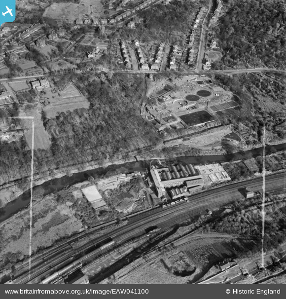
EAW041100 ENGLAND (1951). The St Helens Gelatine Works and the Sewage Works off Abbey Road, Cragg Hill, 1951. This image was marked by Aerofilms Ltd for photo editing.
© Hawlfraint cyfranwyr OpenStreetMap a thrwyddedwyd gan yr OpenStreetMap Foundation. 2026. Trwyddedir y gartograffeg fel CC BY-SA.
Delweddau cyfagos (8)
EAW041100

EAW041098

EAW041101

EAW041104

EAW041097

EAW041099

EAW041102

EAW041103

Manylion
| Pennawd | [EAW041100] The St Helens Gelatine Works and the Sewage Works off Abbey Road, Cragg Hill, 1951. This image was marked by Aerofilms Ltd for photo editing. |
| Cyfeirnod | EAW041100 |
| Dyddiad | 31-October-1951 |
| Dolen | |
| Enw lle | CRAGG HILL |
| Plwyf | HORSFORTH |
| Ardal | |
| Gwlad | ENGLAND |
| Dwyreiniad / Gogleddiad | 424312, 436960 |
| Hydred / Lledred | -1.6305884319272, 53.828124705636 |
| Cyfeirnod Grid Cenedlaethol | SE243370 |
Pinnau
Byddwch y cyntaf i ychwanegu sylw at y ddelwedd hon!
