
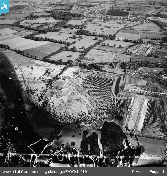
EAW041019 ENGLAND (1951). Clay pit between Sandy Lane and Purfleet Road, Aveley, 1951. This image has been produced from a damaged negative.
© Hawlfraint cyfranwyr OpenStreetMap a thrwyddedwyd gan yr OpenStreetMap Foundation. 2026. Trwyddedir y gartograffeg fel CC BY-SA.
Delweddau cyfagos (9)
EAW041019

EAW041022

EAW041021

EAW041020

EAW041023

EAW041027

EAW041025

EAW041024

EAW041026

Manylion
| Pennawd | [EAW041019] Clay pit between Sandy Lane and Purfleet Road, Aveley, 1951. This image has been produced from a damaged negative. |
| Cyfeirnod | EAW041019 |
| Dyddiad | 23-October-1951 |
| Dolen | |
| Enw lle | AVELEY |
| Plwyf | |
| Ardal | |
| Gwlad | ENGLAND |
| Dwyreiniad / Gogleddiad | 555963, 180616 |
| Hydred / Lledred | 0.24735825807771, 51.502446602072 |
| Cyfeirnod Grid Cenedlaethol | TQ560806 |
Pinnau

Cyfraniadau Grŵp
Tunnel Portland Cement Company Ltd clayfields supplying London Clay pumped as slurry to the West Thurrock cement plant. Opened 1927, closed 1976. At this time processing around 0.5 million tonnes of raw clay per year, later increased to 0.7 million. |

Dylan Moore |
Tuesday 29th of April 2014 09:32:10 AM |