
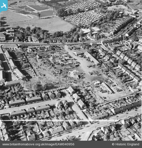
EAW040956 ENGLAND (1951). The site of the Brooke Trading Estate, Romford, 1951. This image was marked by Aerofilms Ltd for photo editing.
© Hawlfraint cyfranwyr OpenStreetMap a thrwyddedwyd gan yr OpenStreetMap Foundation. 2026. Trwyddedir y gartograffeg fel CC BY-SA.
Delweddau cyfagos (12)
EAW040956

EAW040958

EAW040953

EAW040955

EAW040959

EAW040957

EAW040954

EAW040960

EAW013348

EAW013350

EAW013354

EAW013351

Manylion
| Pennawd | [EAW040956] The site of the Brooke Trading Estate, Romford, 1951. This image was marked by Aerofilms Ltd for photo editing. |
| Cyfeirnod | EAW040956 |
| Dyddiad | 17-October-1951 |
| Dolen | |
| Enw lle | ROMFORD |
| Plwyf | |
| Ardal | |
| Gwlad | ENGLAND |
| Dwyreiniad / Gogleddiad | 551776, 187870 |
| Hydred / Lledred | 0.19020111025381, 51.568770260503 |
| Cyfeirnod Grid Cenedlaethol | TQ518879 |
Pinnau

Tommy |
Saturday 25th of February 2017 09:25:41 AM | |
|
Tommy |
Saturday 25th of February 2017 09:24:50 AM | |
|
GeoffR |
Friday 16th of January 2015 05:55:18 PM | |
|
GeoffR |
Friday 16th of January 2015 05:52:34 PM |
Cyfraniadau Grŵp

I have attached an aerial view of this area in 2016 |
Tommy |
Saturday 25th of February 2017 09:36:52 AM |