
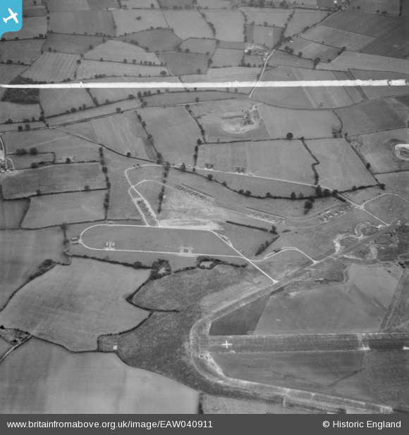
EAW040911 ENGLAND (1951). The Birch Pit (sand and gravel) alongside Birch Airfield, Birch, 1951. This image was marked by Aerofilms Ltd for photo editing.
© Hawlfraint cyfranwyr OpenStreetMap a thrwyddedwyd gan yr OpenStreetMap Foundation. 2026. Trwyddedir y gartograffeg fel CC BY-SA.
Delweddau cyfagos (9)
EAW040911
 alongside Birch Airfield, Birch, 1951. This image was marked by Aerofilms Ltd for photo editing.")
EAW040908
 alongside Birch Airfield, Birch, 1951. This image was marked by Aerofilms Ltd for photo editing.")
EAW040909
 alongside Birch Airfield, Birch, 1951. This image was marked by Aerofilms Ltd for photo editing.")
EAW040912
 alongside Birch Airfield, Birch, 1951. This image was marked by Aerofilms Ltd for photo editing.")
EAW040910
 alongside Birch Airfield, Birch, 1951. This image was marked by Aerofilms Ltd for photo editing.")
EAW041053

EAW041054

EAW041056

EAW041055

Manylion
| Pennawd | [EAW040911] The Birch Pit (sand and gravel) alongside Birch Airfield, Birch, 1951. This image was marked by Aerofilms Ltd for photo editing. |
| Cyfeirnod | EAW040911 |
| Dyddiad | 18-October-1951 |
| Dolen | |
| Enw lle | BIRCH |
| Plwyf | BIRCH |
| Ardal | |
| Gwlad | ENGLAND |
| Dwyreiniad / Gogleddiad | 592742, 219819 |
| Hydred / Lledred | 0.79834876224534, 51.843208049207 |
| Cyfeirnod Grid Cenedlaethol | TL927198 |
