
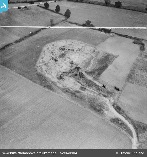
EAW040904 ENGLAND (1951). The Birch Pit (sand and gravel), Birch, 1951. This image was marked by Aerofilms Ltd for photo editing.
© Hawlfraint cyfranwyr OpenStreetMap a thrwyddedwyd gan yr OpenStreetMap Foundation. 2026. Trwyddedir y gartograffeg fel CC BY-SA.
Delweddau cyfagos (9)
EAW040904
, Birch, 1951. This image was marked by Aerofilms Ltd for photo editing.")
EAW040905
, Birch, 1951. This image was marked by Aerofilms Ltd for photo editing.")
EAW040903
, Birch, 1951. This image was marked by Aerofilms Ltd for photo editing.")
EAW040914
 alongside Birch Airfield, Birch, 1951. This image was marked by Aerofilms Ltd for photo editing.")
EAW040913
 alongside Birch Airfield, Birch, 1951. This image was marked by Aerofilms Ltd for photo editing.")
EAW040907
 alongside Birch Airfield, Birch, 1951. This image was marked by Aerofilms Ltd for photo editing.")
EAW040906
 alongside Birch Airfield, Birch, 1951. This image was marked by Aerofilms Ltd for photo editing.")
EAW041057

EAW041055

Manylion
| Pennawd | [EAW040904] The Birch Pit (sand and gravel), Birch, 1951. This image was marked by Aerofilms Ltd for photo editing. |
| Cyfeirnod | EAW040904 |
| Dyddiad | 18-October-1951 |
| Dolen | |
| Enw lle | BIRCH |
| Plwyf | BIRCH |
| Ardal | |
| Gwlad | ENGLAND |
| Dwyreiniad / Gogleddiad | 592783, 219326 |
| Hydred / Lledred | 0.79866848516946, 51.838766139788 |
| Cyfeirnod Grid Cenedlaethol | TL928193 |
Pinnau

Matt Aldred edob.mattaldred.com |
Sunday 23rd of February 2025 05:12:25 PM | |

redmist |
Tuesday 11th of October 2022 09:44:56 AM |