
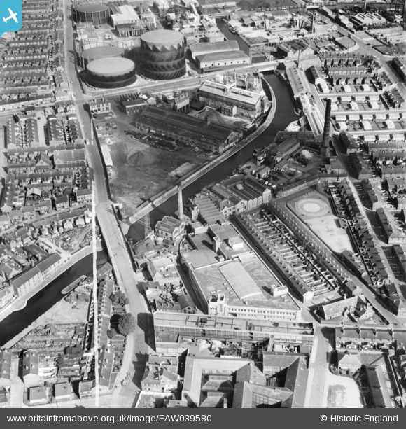
EAW039580 ENGLAND (1951). The Williams Toffee Works and the surrounding area, Bootle, 1951. This image was marked by Aerofilms Ltd for photo editing.
© Hawlfraint cyfranwyr OpenStreetMap a thrwyddedwyd gan yr OpenStreetMap Foundation. 2026. Trwyddedir y gartograffeg fel CC BY-SA.
Delweddau cyfagos (8)
EAW039580

EAW039581

EAW039584

EAW039586

EAW039582

EAW039583

EAW039585

EPW011167

Manylion
| Pennawd | [EAW039580] The Williams Toffee Works and the surrounding area, Bootle, 1951. This image was marked by Aerofilms Ltd for photo editing. |
| Cyfeirnod | EAW039580 |
| Dyddiad | 9-September-1951 |
| Dolen | |
| Enw lle | BOOTLE |
| Plwyf | |
| Ardal | |
| Gwlad | ENGLAND |
| Dwyreiniad / Gogleddiad | 334566, 395614 |
| Hydred / Lledred | -2.9854731811175, 53.452959929396 |
| Cyfeirnod Grid Cenedlaethol | SJ346956 |
