
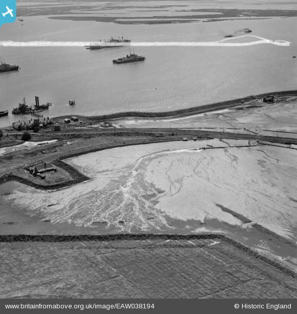
EAW038194 ENGLAND (1951). The Old Salt Works at Stan Marsh and vessels off Port Victoria, Isle of Grain, 1951. This image was marked by Aerofilms Ltd for photo editing.
© Hawlfraint cyfranwyr OpenStreetMap a thrwyddedwyd gan yr OpenStreetMap Foundation. 2026. Trwyddedir y gartograffeg fel CC BY-SA.
Delweddau cyfagos (14)
EAW038194

EAW038190

EAW038183

EAW038185

EAW038186

EAW048521

EAW038188

EAW038195

EAW038196

EAW038193

EAW038187

EAW038189

EAW045759

EAW038207

Manylion
| Pennawd | [EAW038194] The Old Salt Works at Stan Marsh and vessels off Port Victoria, Isle of Grain, 1951. This image was marked by Aerofilms Ltd for photo editing. |
| Cyfeirnod | EAW038194 |
| Dyddiad | 2-August-1951 |
| Dolen | |
| Enw lle | ISLE OF GRAIN |
| Plwyf | ISLE OF GRAIN |
| Ardal | |
| Gwlad | ENGLAND |
| Dwyreiniad / Gogleddiad | 587739, 174085 |
| Hydred / Lledred | 0.70126579531729, 51.434120758376 |
| Cyfeirnod Grid Cenedlaethol | TQ877741 |
Pinnau

Kentishman |
Sunday 24th of July 2016 10:37:46 PM | |
|
Kentishman |
Sunday 24th of July 2016 10:31:57 PM | |
|
Kentishman |
Sunday 24th of July 2016 10:25:21 PM | |
|
Kentishman |
Friday 22nd of July 2016 12:37:49 PM | |
|
Kentishman |
Friday 22nd of July 2016 12:08:12 PM | |
|
Ellen Bignell |
Friday 6th of June 2014 05:34:33 PM |
Cyfraniadau Grŵp
This photograph may show an area of "old salt works" but the operation shown in the series of photographs is land reclamation using dredged sand/silt that is being pumped into an area surrounded by an earthen wall or bund. When the area was full, and the water drained away, building could take place on an area that was originally saltmarsh and regularly flooded on high tides. |
Tony Banks |
Friday 6th of June 2014 10:55:14 PM |