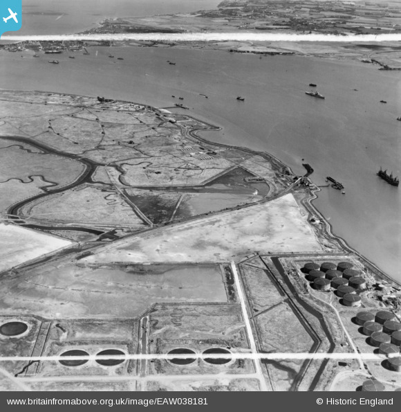
EAW038181 ENGLAND (1951). Horseshoe Point, the River Medway and environs, Isle of Grain, 1951. This image has been produced from a print marked by Aerofilms Ltd for photo editing.

© Hawlfraint cyfranwyr OpenStreetMap a thrwyddedwyd gan yr OpenStreetMap Foundation. 2024. Trwyddedir y gartograffeg fel CC BY-SA.

Delweddau cyfagos (3)

EAW038181
  0° 0m
EAW045759
  218° 113m
EAW038192
  254° 252m

Manylion

Pennawd [EAW038181] Horseshoe Point, the River Medway and environs, Isle of Grain, 1951. This image has been produced from a print marked by Aerofilms Ltd for photo editing.
Cyfeirnod EAW038181
Dyddiad 2-August-1951
Dolen
Enw lle ISLE OF GRAIN
Plwyf ISLE OF GRAIN
Ardal
Gwlad ENGLAND
Dwyreiniad / Gogleddiad 587923, 174405
Hydred / Lledred 0.70407992717331, 51.436934182756
Cyfeirnod Grid Cenedlaethol TQ879744

Pinnau

? 2ndWW pillbox.

redmist
Sunday 23rd of January 2022 10:15:04 PM
2ndWW HAA Gun Battery, designation TS11/- (GDA Thames & Medway).

redmist
Sunday 23rd of January 2022 10:11:08 PM
2ndWW pillbox, e35748.

redmist
Sunday 23rd of January 2022 10:09:14 PM
2ndWW pillbox, type FW3/22.

redmist
Sunday 23rd of January 2022 10:06:21 PM
2ndWW HAA gun emplacement.

redmist
Sunday 23rd of January 2022 09:58:58 PM

redmist
Sunday 23rd of January 2022 09:56:50 PM
Sheerness Docks

The Laird
Sunday 24th of July 2016 01:23:53 PM
Railway siding and run-around originally laid to supply RNAS Grain and Port Victoria Marine Aircraft Experimental Depot.

Kentishman
Friday 22nd of July 2016 02:31:10 PM
Site of the Marine Aircraft Experimental Depot, Port Victoria, established in 1915. Although it was first set up as a repair depot, three main tasks were given to it: to develop aircraft construction, to assess seaplanes and to research armaments. During the years to 1924 when it closed, 10 aircraft were designed of which 9 had prototypes built. These were named PV (after Port Victoria) 1 to 5, 5A, 7 to 9 and the Grain Griffin. It was renamed the Marine and Armament Experimental Establishment in 1920.

Kentishman
Friday 22nd of July 2016 02:26:25 PM
Naval Air Station Grain, Britain's first naval air station, opened on the 3rd December 1912 and was commissioned on the 1st January 1914 as Royal Naval Air Station Grain. Its role was to be an experimental base for seaplanes in the Royal Navy and it was the first of 16 bases for hydro-aeroplanes (as seaplanes were then called) plus 3 for airships initially suggested by the Admiralty. RNAS Kingsnorth was an airship base 5.5 miles to the West South West (see image EPW047581 ), it was completed in April 1914. RNAS Grain's main buildings were in the narrow triangle of land bounded by the sea wall to the East, the Old Counter Wall to the West with Cockleshell Hard at its apex in the South. I don't believe that any of the buildings shown in this image remained from the base. On the 1st April 1918, upon the formation of the Royal Air Force, RNAS Grain became RAF Grain. The station was closed on the 24th March 1924. See the last post on this page for a brief history of military aviation at Grain: http://www.kenthistoryforum.co.uk/index.php?topic=3206.10;wap2 For some photo's, see http://www.tondernraid.com/landingtrials.htm For plans, see http://sussexhistoryforum.co.uk/index.php?topic=3054.0 but you have to register to see the items.

Kentishman
Friday 22nd of July 2016 09:09:55 AM
Port Victoria

Brightonboy
Thursday 21st of July 2016 09:07:00 PM
'Old Counter Wall' per OS maps

Kentishman
Thursday 21st of July 2016 08:26:57 PM
Cockleshell Hard

Kentishman
Thursday 21st of July 2016 07:02:40 PM
Horseshoe Point

Kentishman
Thursday 21st of July 2016 06:54:12 PM