
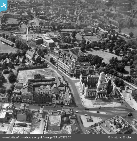
EAW037865 ENGLAND (1951). The Guildhall, Park Building and the surrounding area, Portsmouth, 1951. This image has been produced from a print.
© Hawlfraint cyfranwyr OpenStreetMap a thrwyddedwyd gan yr OpenStreetMap Foundation. 2026. Trwyddedir y gartograffeg fel CC BY-SA.
Delweddau cyfagos (10)
EAW037865

EAW037867

EAW037866

EAW035212

EAW035209

EAW035215

EAW035207

EAW035214

EAW035213

EAW035206

Manylion
| Pennawd | [EAW037865] The Guildhall, Park Building and the surrounding area, Portsmouth, 1951. This image has been produced from a print. |
| Cyfeirnod | EAW037865 |
| Dyddiad | 19-July-1951 |
| Dolen | |
| Enw lle | PORTSMOUTH |
| Plwyf | |
| Ardal | |
| Gwlad | ENGLAND |
| Dwyreiniad / Gogleddiad | 463956, 100157 |
| Hydred / Lledred | -1.0924131341469, 50.796878047222 |
| Cyfeirnod Grid Cenedlaethol | SU640002 |
