
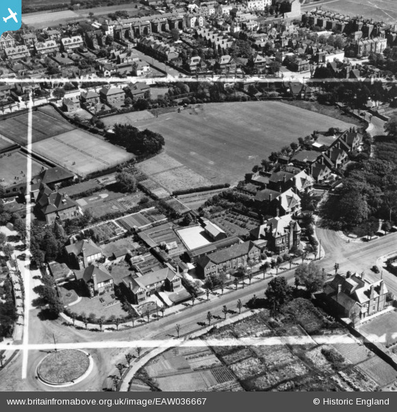
EAW036667 ENGLAND (1951). Houses around the junction of Maltravers Drive and Fitzalan Road and the playing field behind Granville Road, Littlehampton, 1951. This image has been produced from a print marked by Aerofilms Ltd for photo editing.
© Hawlfraint cyfranwyr OpenStreetMap a thrwyddedwyd gan yr OpenStreetMap Foundation. 2026. Trwyddedir y gartograffeg fel CC BY-SA.
Delweddau cyfagos (8)
EAW036667

EAW036668

EAW036669

EAW036670

EAW036673

EAW036666

EAW036671

EAW036672

Manylion
| Pennawd | [EAW036667] Houses around the junction of Maltravers Drive and Fitzalan Road and the playing field behind Granville Road, Littlehampton, 1951. This image has been produced from a print marked by Aerofilms Ltd for photo editing. |
| Cyfeirnod | EAW036667 |
| Dyddiad | 1-June-1951 |
| Dolen | |
| Enw lle | LITTLEHAMPTON |
| Plwyf | LITTLEHAMPTON |
| Ardal | |
| Gwlad | ENGLAND |
| Dwyreiniad / Gogleddiad | 503248, 101829 |
| Hydred / Lledred | -0.53451558753132, 50.806241276604 |
| Cyfeirnod Grid Cenedlaethol | TQ032018 |
Pinnau
Byddwch y cyntaf i ychwanegu sylw at y ddelwedd hon!