
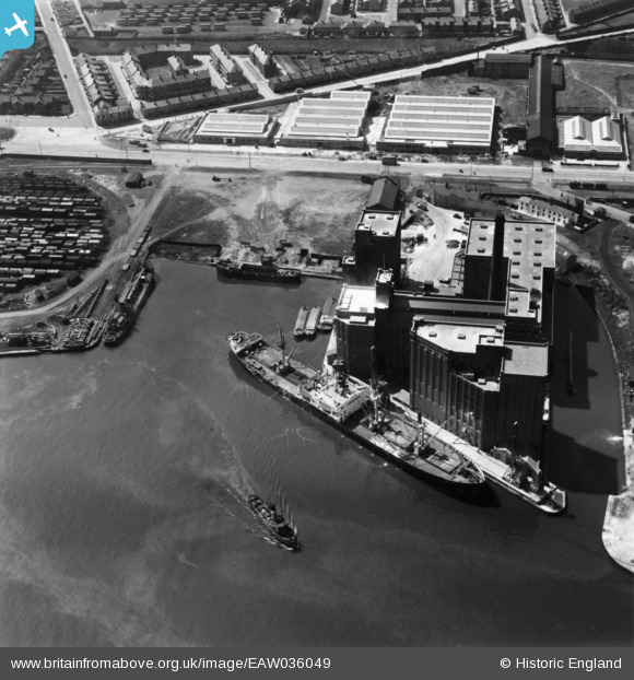
EAW036049 ENGLAND (1951). Joseph Rank Ltd Ocean Flour Mills and Gill Basin Dock, Birkenhead, 1951. This image has been produced from a print.
© Hawlfraint cyfranwyr OpenStreetMap a thrwyddedwyd gan yr OpenStreetMap Foundation. 2026. Trwyddedir y gartograffeg fel CC BY-SA.
Delweddau cyfagos (23)
EAW036049

EAW038503

EAW038504

EAW038505

EAW036054

EAW038507

EAW036048

EAW036050

EAW036051

EAW036053

EAW038501

EAW038508

EAW036052

EAW038506

EAW038502

EAW038500

EAW001724

EPW041994

EPW041997

EPW041995

EAW398267

EPW041996

EAW001790

Manylion
| Pennawd | [EAW036049] Joseph Rank Ltd Ocean Flour Mills and Gill Basin Dock, Birkenhead, 1951. This image has been produced from a print. |
| Cyfeirnod | EAW036049 |
| Dyddiad | 11-May-1951 |
| Dolen | |
| Enw lle | BIRKENHEAD |
| Plwyf | |
| Ardal | |
| Gwlad | ENGLAND |
| Dwyreiniad / Gogleddiad | 330487, 390196 |
| Hydred / Lledred | -3.0456983887643, 53.403740132856 |
| Cyfeirnod Grid Cenedlaethol | SJ305902 |
