
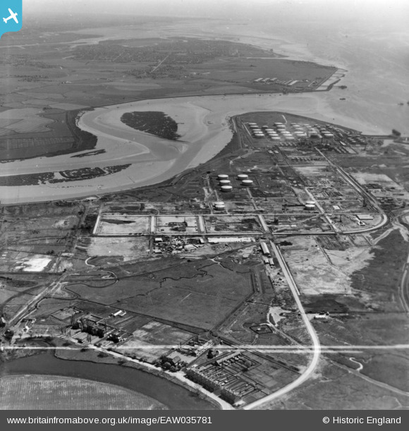
EAW035781 ENGLAND (1951). The Coryton Oil Refinery alongside Holehaven Creek, Coryton, from the west, 1951. This image has been produced from a print marked by Aerofilms Ltd for photo editing.
© Hawlfraint cyfranwyr OpenStreetMap a thrwyddedwyd gan yr OpenStreetMap Foundation. 2026. Trwyddedir y gartograffeg fel CC BY-SA.
Delweddau cyfagos (9)
EAW035781

EAW047423

EAW048598

EAW035780

EAW034410

EAW048597

EAW048100

EAW048092

EAW034442

Manylion
| Pennawd | [EAW035781] The Coryton Oil Refinery alongside Holehaven Creek, Coryton, from the west, 1951. This image has been produced from a print marked by Aerofilms Ltd for photo editing. |
| Cyfeirnod | EAW035781 |
| Dyddiad | 12-May-1951 |
| Dolen | |
| Enw lle | CORYTON |
| Plwyf | |
| Ardal | |
| Gwlad | ENGLAND |
| Dwyreiniad / Gogleddiad | 574382, 182460 |
| Hydred / Lledred | 0.51341980354486, 51.513630007578 |
| Cyfeirnod Grid Cenedlaethol | TQ744825 |
Pinnau
Byddwch y cyntaf i ychwanegu sylw at y ddelwedd hon!