
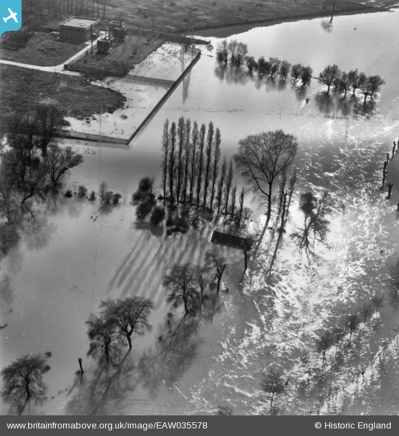
EAW035578 ENGLAND (1951). The River Great Ouse in flood by the Transport Depot, Kempston, 1951. This image has been produced from a print.
© Hawlfraint cyfranwyr OpenStreetMap a thrwyddedwyd gan yr OpenStreetMap Foundation. 2026. Trwyddedir y gartograffeg fel CC BY-SA.
Delweddau cyfagos (6)
EAW035578

EAW035579

EPW046440

EPW046442

EAW018301

EAW003720

Manylion
| Pennawd | [EAW035578] The River Great Ouse in flood by the Transport Depot, Kempston, 1951. This image has been produced from a print. |
| Cyfeirnod | EAW035578 |
| Dyddiad | 11-April-1951 |
| Dolen | |
| Enw lle | KEMPSTON |
| Plwyf | KEMPSTON |
| Ardal | |
| Gwlad | ENGLAND |
| Dwyreiniad / Gogleddiad | 504014, 248845 |
| Hydred / Lledred | -0.48036010697794, 52.127702099583 |
| Cyfeirnod Grid Cenedlaethol | TL040488 |
Pinnau

melgibbs |
Sunday 9th of November 2014 10:40:42 AM | |
|
melgibbs |
Sunday 9th of November 2014 10:39:03 AM | |
|
melgibbs |
Sunday 9th of November 2014 10:37:45 AM | |
|
melgibbs |
Saturday 8th of November 2014 04:24:39 PM | |
|
melgibbs |
Saturday 8th of November 2014 04:24:05 PM | |
|
melgibbs |
Saturday 8th of November 2014 04:21:27 PM |