
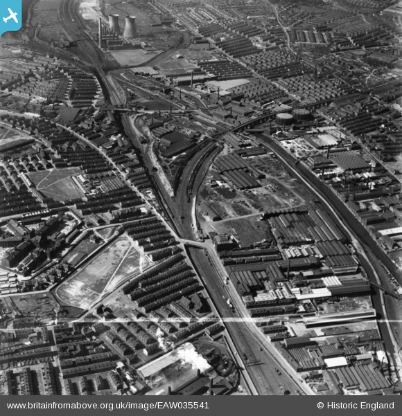
EAW035541 ENGLAND (1951). The Wilsons and Mathiesons Ltd Scotch Iron Foundry and the surrounding industrial area, Armley, 1951. This image has been produced from a print marked by Aerofilms Ltd for photo editing.
© Hawlfraint cyfranwyr OpenStreetMap a thrwyddedwyd gan yr OpenStreetMap Foundation. 2026. Trwyddedir y gartograffeg fel CC BY-SA.
Delweddau cyfagos (13)
EAW035541

EAW035543

EAW035538

EAW035542

EAW035539

EAW035545

EAW035544

EAW044388

EAW035540

EPW020775

EAW044387

EPW020770

EAW044394

Manylion
| Pennawd | [EAW035541] The Wilsons and Mathiesons Ltd Scotch Iron Foundry and the surrounding industrial area, Armley, 1951. This image has been produced from a print marked by Aerofilms Ltd for photo editing. |
| Cyfeirnod | EAW035541 |
| Dyddiad | 21-April-1951 |
| Dolen | |
| Enw lle | ARMLEY |
| Plwyf | |
| Ardal | |
| Gwlad | ENGLAND |
| Dwyreiniad / Gogleddiad | 428019, 433811 |
| Hydred / Lledred | -1.5745503345888, 53.799632508125 |
| Cyfeirnod Grid Cenedlaethol | SE280338 |
