
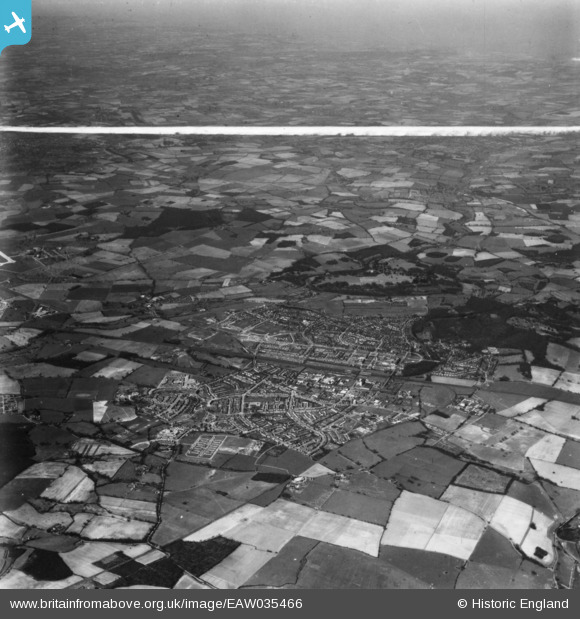
EAW035466 ENGLAND (1951). The town and surrounding countryside, Welwyn Garden City, from the east, 1951. This image has been produced from a print marked by Aerofilms Ltd for photo editing.
© Hawlfraint cyfranwyr OpenStreetMap a thrwyddedwyd gan yr OpenStreetMap Foundation. 2026. Trwyddedir y gartograffeg fel CC BY-SA.
Delweddau cyfagos (3)
EAW035466

EPW047372

EPW047373

Manylion
| Pennawd | [EAW035466] The town and surrounding countryside, Welwyn Garden City, from the east, 1951. This image has been produced from a print marked by Aerofilms Ltd for photo editing. |
| Cyfeirnod | EAW035466 |
| Dyddiad | 17-April-1951 |
| Dolen | |
| Enw lle | WELWYN GARDEN CITY |
| Plwyf | |
| Ardal | |
| Gwlad | ENGLAND |
| Dwyreiniad / Gogleddiad | 525141, 212435 |
| Hydred / Lledred | -0.18511796337249, 51.79609600183 |
| Cyfeirnod Grid Cenedlaethol | TL251124 |
