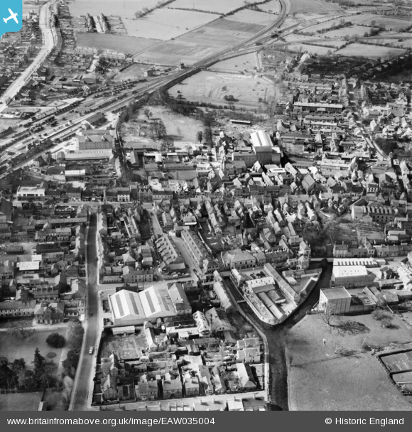
EAW035004 ENGLAND (1951). Castle Field and the town centre, Sleaford, 1951

© Hawlfraint cyfranwyr OpenStreetMap a thrwyddedwyd gan yr OpenStreetMap Foundation. 2025. Trwyddedir y gartograffeg fel CC BY-SA.

Delweddau cyfagos (7)

EAW035004
  0° 0m
EAW035003
  3° 165m
EPW016183
  4° 175m
EPW013045
  332° 219m
EAW035001
  196° 243m
EPW016184
  343° 246m
EAW035002
  313° 265m

Manylion

Pennawd [EAW035004] Castle Field and the town centre, Sleaford, 1951
Cyfeirnod EAW035004
Dyddiad 20-March-1951
Dolen
Enw lle SLEAFORD
Plwyf SLEAFORD
Ardal
Gwlad ENGLAND
Dwyreiniad / Gogleddiad 506865, 345643
Hydred / Lledred -0.4075191669278, 52.997127762926
Cyfeirnod Grid Cenedlaethol TF069456

Pinnau

Money's Mill tower, now standing isolated in Money's Yard car park

Moonraker
Friday 20th of October 2023 11:04:40 AM
Navigation House, headquarters of the Sleaford Navigation which opened in 1794. Built in the 1830s on the wharf at the head of the Navigation it originally contained a weighbridge and the company's office. Later used as a warehouse it fell into disuse and disrepair and was in danger of being demolished. Local feeling which was strongly against this happening, lead to the founding of the Sleaford Navigation Society which was able to purchase the building. Between 1995 and 2001, the Sleaford Pride Regeneration Project drew on funding from a variety of sources to advance development within the town and in 1998 the Navigation Stables were converted into small business units. Heritage Lottery money provided the funding for the stabilizing and restoration of Navigation House but it was agreed that the idiosyncratic tilt of the house, occasioned by the positioning of the weighing mechanism, should be preserved. Following painstaking restoration, Navigation House was re-opened as a Visitors’ Centre in 2005

Moonraker
Friday 20th of October 2023 10:55:35 AM
Branch line to RAF Cranwell

FSMMF
Thursday 15th of October 2015 07:37:11 AM
GN&GE joint line

bescotbeast
Saturday 7th of February 2015 11:42:29 AM