
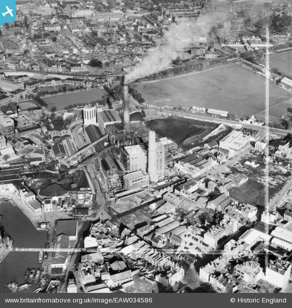
EAW034586 ENGLAND (1951). Portsmouth Power Station off Gunwharf Road and environs, Portsmouth, 1951. This image was marked by Aerofilms Ltd for photo editing.
© Hawlfraint cyfranwyr OpenStreetMap a thrwyddedwyd gan yr OpenStreetMap Foundation. 2026. Trwyddedir y gartograffeg fel CC BY-SA.
Delweddau cyfagos (35)
EAW034586

EAW032155

EAW037853

EAW034587

EAW032152

EAW032150

EAW034585

EAW032151

EAW034592

EAW034591

EAW032148

EAW032156

EAW034590

EAW034588

EAW032147

EAW034589

EAW037862

EAW034584

EAW037860

EAW032153

EAW037859

EAW032154

EAW037855
 off Gunwharf Road, Old Portsmouth, 1951. This image has been produced from a damaged negative.")
EAW037863

EAW034581

EAW037854

EAW034583

EAW032149

EAW034582

EAW037858

EAW037857

EAW037852
 off Gunwharf Road, Old Portsmouth, 1951. This image has been produced from a damaged negative.")
EAW037861
 off Gunwharf Road, Old Portsmouth, 1951. This image has been produced from a damaged negative.")
EAW032157

EAW037856
 off Gunwharf Road, Old Portsmouth, 1951. This image has been produced from a damaged negative.")
Manylion
| Pennawd | [EAW034586] Portsmouth Power Station off Gunwharf Road and environs, Portsmouth, 1951. This image was marked by Aerofilms Ltd for photo editing. |
| Cyfeirnod | EAW034586 |
| Dyddiad | 7-February-1951 |
| Dolen | |
| Enw lle | PORTSMOUTH |
| Plwyf | |
| Ardal | |
| Gwlad | ENGLAND |
| Dwyreiniad / Gogleddiad | 463274, 99628 |
| Hydred / Lledred | -1.1021811322279, 50.792195905896 |
| Cyfeirnod Grid Cenedlaethol | SZ633996 |
Pinnau

Keith Palmer |
Thursday 23rd of April 2020 09:34:13 AM | |

Class31 |
Thursday 16th of October 2014 11:25:05 PM | |
|
Class31 |
Thursday 16th of October 2014 11:14:18 PM | |
|
Class31 |
Thursday 16th of October 2014 10:50:33 PM | |
|
Class31 |
Thursday 16th of October 2014 10:40:48 PM |