
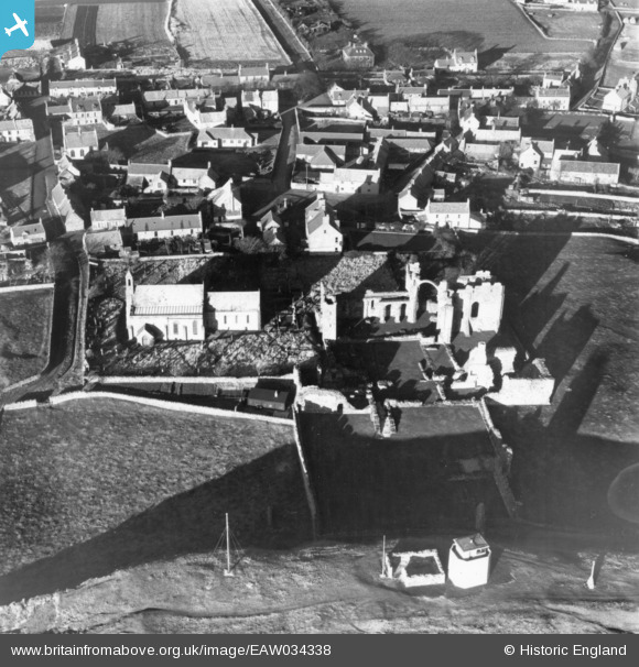
EAW034338 ENGLAND (1950). The remains of Lindisfarne Priory alongside St Mary's Church and the village, Holy Island, 1950. This image has been produced from a print.
© Hawlfraint cyfranwyr OpenStreetMap a thrwyddedwyd gan yr OpenStreetMap Foundation. 2026. Trwyddedir y gartograffeg fel CC BY-SA.
Delweddau cyfagos (16)
EAW034338

EAW034339

EAW034336

EAW034335

EAW034337

EAW006096

EAW007937

EAW006097

EAW007934

EAW007932

EAW007936

EAW034334

EAW006095

EAW007933

EAW007935

EAW006094

Manylion
| Pennawd | [EAW034338] The remains of Lindisfarne Priory alongside St Mary's Church and the village, Holy Island, 1950. This image has been produced from a print. |
| Cyfeirnod | EAW034338 |
| Dyddiad | 25-November-1950 |
| Dolen | |
| Enw lle | HOLY ISLAND |
| Plwyf | HOLY ISLAND |
| Ardal | |
| Gwlad | ENGLAND |
| Dwyreiniad / Gogleddiad | 412599, 641772 |
| Hydred / Lledred | -1.7996762462898, 55.669297095943 |
| Cyfeirnod Grid Cenedlaethol | NU126418 |
Pinnau
 |

melgibbs |
Friday 4th of November 2016 08:19:53 PM |