
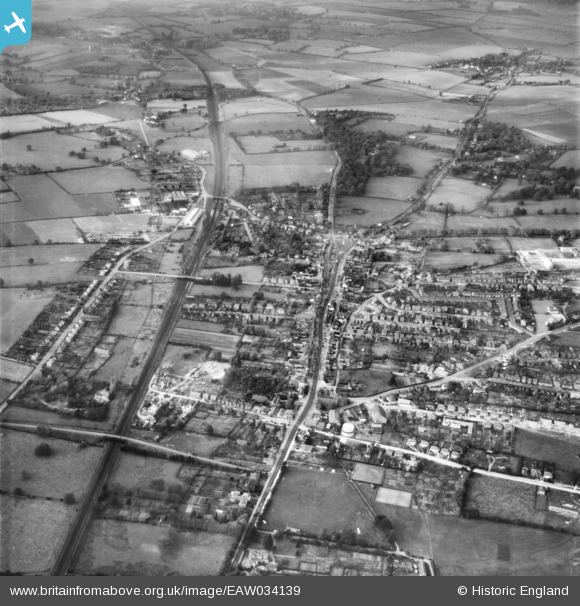
EAW034139 ENGLAND (1950). The High Street and town, Stevenage, from the nsouth-east, 1950
© Hawlfraint cyfranwyr OpenStreetMap a thrwyddedwyd gan yr OpenStreetMap Foundation. 2026. Trwyddedir y gartograffeg fel CC BY-SA.
Delweddau cyfagos (7)
EAW034139

EPW013410

EPW013411

EPW025524

EAW032039

EAW034136

EAW023206

Manylion
| Pennawd | [EAW034139] The High Street and town, Stevenage, from the nsouth-east, 1950 |
| Cyfeirnod | EAW034139 |
| Dyddiad | 26-October-1950 |
| Dolen | |
| Enw lle | STEVENAGE |
| Plwyf | |
| Ardal | |
| Gwlad | ENGLAND |
| Dwyreiniad / Gogleddiad | 523464, 224779 |
| Hydred / Lledred | -0.20501636371645, 51.907411236512 |
| Cyfeirnod Grid Cenedlaethol | TL235248 |
Pinnau

Chells809 |
Wednesday 28th of June 2023 04:47:07 PM | |
|
Chells809 |
Wednesday 28th of June 2023 03:51:17 PM | |
|
Chells809 |
Wednesday 28th of June 2023 03:50:44 PM | |
|
andy |
Monday 22nd of July 2019 05:05:49 PM | |
|
banger pestell |
Friday 10th of February 2017 02:03:12 PM | |
|
Howie |
Monday 14th of March 2016 03:56:40 AM | |

melgibbs |
Thursday 19th of March 2015 08:51:36 PM | |
|
omgh |
Friday 12th of September 2014 05:28:06 PM | |
|
Oldtimer |
Saturday 26th of July 2014 12:24:42 AM | |
Hi,saw your comment,I saw this a while back and wondered myself, image epw013408 |
boltie |
Saturday 26th of July 2014 02:55:50 AM |
|
Chells809 |
Saturday 10th of May 2014 11:23:12 PM | |
Was to be closed in 1973 with the opening of a new station about a mile southwards to be nearer the New Town centre - roughly the bottom edge of this photograph. |
John W |
Thursday 5th of January 2017 08:19:04 PM |