
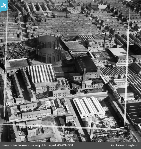
EAW034001 ENGLAND (1950). Hartford Mills and the Gas Holders off Ribbleton Lane, Preston, 1950. This image was marked by Aerofilms Ltd for photo editing.
© Hawlfraint cyfranwyr OpenStreetMap a thrwyddedwyd gan yr OpenStreetMap Foundation. 2026. Trwyddedir y gartograffeg fel CC BY-SA.
Delweddau cyfagos (16)
EAW034001

EAW034002

EAW034003

EAW034006

EAW034005

EAW034000

EAW033999

EAW034004

EAW015900

EAW015899

EPW004016

EAW015896

EAW015898

EAW015897

EPW013072

EAW015895

Manylion
| Pennawd | [EAW034001] Hartford Mills and the Gas Holders off Ribbleton Lane, Preston, 1950. This image was marked by Aerofilms Ltd for photo editing. |
| Cyfeirnod | EAW034001 |
| Dyddiad | 14-October-1950 |
| Dolen | |
| Enw lle | PRESTON |
| Plwyf | |
| Ardal | |
| Gwlad | ENGLAND |
| Dwyreiniad / Gogleddiad | 355093, 429930 |
| Hydred / Lledred | -2.6813010456945, 53.763564796901 |
| Cyfeirnod Grid Cenedlaethol | SD551299 |
Pinnau

Sparky |
Thursday 7th of September 2017 09:01:46 AM |