
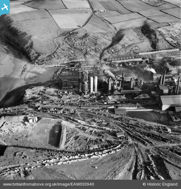
EAW033940 ENGLAND (1950). The Skinningrove Iron Co Ltd Works, Skinningrove, 1950
© Hawlfraint cyfranwyr OpenStreetMap a thrwyddedwyd gan yr OpenStreetMap Foundation. 2026. Trwyddedir y gartograffeg fel CC BY-SA.
Delweddau cyfagos (7)
EAW033940

EAW033942

EAW033944

EAW033938

EAW033943

EAW033939

EAW033941

Manylion
| Pennawd | [EAW033940] The Skinningrove Iron Co Ltd Works, Skinningrove, 1950 |
| Cyfeirnod | EAW033940 |
| Dyddiad | October-1950 |
| Dolen | |
| Enw lle | SKINNINGROVE |
| Plwyf | LOFTUS |
| Ardal | |
| Gwlad | ENGLAND |
| Dwyreiniad / Gogleddiad | 471054, 520075 |
| Hydred / Lledred | -0.90080825727098, 54.570773115552 |
| Cyfeirnod Grid Cenedlaethol | NZ711201 |
