
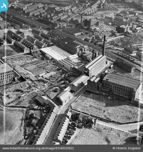
EAW033821 ENGLAND (1950). Waterfall Mills and Waterfall Nurseries, Mill Hill, 1950. This image was marked by Aerofilms Ltd for photo editing.
© Hawlfraint cyfranwyr OpenStreetMap a thrwyddedwyd gan yr OpenStreetMap Foundation. 2026. Trwyddedir y gartograffeg fel CC BY-SA.
Delweddau cyfagos (14)
EAW033821

EAW033817

EAW033822

EAW033818

EAW033813

EAW033816

EAW033820

EAW033815

EAW033814

EAW033819

EAW033824

EAW033823

EPW013920

EAW028419

Manylion
| Pennawd | [EAW033821] Waterfall Mills and Waterfall Nurseries, Mill Hill, 1950. This image was marked by Aerofilms Ltd for photo editing. |
| Cyfeirnod | EAW033821 |
| Dyddiad | 16-October-1950 |
| Dolen | |
| Enw lle | MILL HILL |
| Plwyf | |
| Ardal | |
| Gwlad | ENGLAND |
| Dwyreiniad / Gogleddiad | 367070, 426825 |
| Hydred / Lledred | -2.4992714077861, 53.736549640562 |
| Cyfeirnod Grid Cenedlaethol | SD671268 |
