
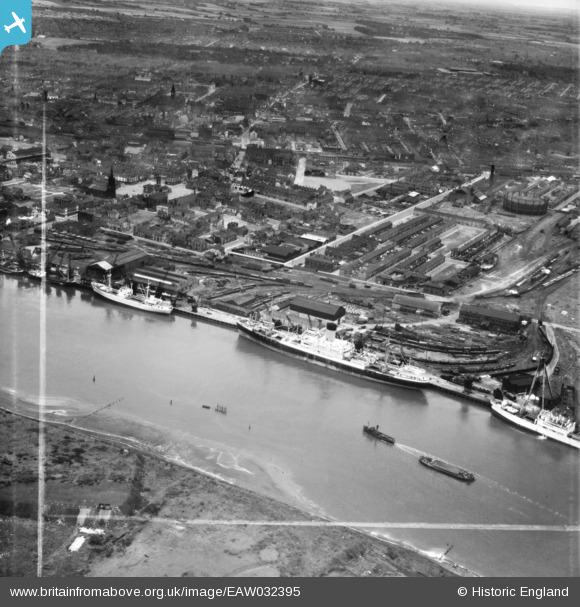
EAW032395 ENGLAND (1950). Dent's Wharf and the town, Middlesbrough, 1950. This image was marked by Aerofilms Ltd for photo editing.
© Hawlfraint cyfranwyr OpenStreetMap a thrwyddedwyd gan yr OpenStreetMap Foundation. 2026. Trwyddedir y gartograffeg fel CC BY-SA.
Delweddau cyfagos (11)
EAW032395

EAW032388

EAW032391

EAW032387

EAW032396

EAW032393

EAW032397

EAW032392

EAW032394

EAW032389

EAW032390

Manylion
| Pennawd | [EAW032395] Dent's Wharf and the town, Middlesbrough, 1950. This image was marked by Aerofilms Ltd for photo editing. |
| Cyfeirnod | EAW032395 |
| Dyddiad | 4-September-1950 |
| Dolen | |
| Enw lle | MIDDLESBROUGH |
| Plwyf | |
| Ardal | |
| Gwlad | ENGLAND |
| Dwyreiniad / Gogleddiad | 449428, 521365 |
| Hydred / Lledred | -1.2351009194976, 54.584942446773 |
| Cyfeirnod Grid Cenedlaethol | NZ494214 |
Pinnau

Stubzi34 |
Wednesday 13th of August 2014 06:40:20 PM | |
|
Stubzi34 |
Wednesday 13th of August 2014 06:36:44 PM | |
|
Stubzi34 |
Wednesday 13th of August 2014 06:35:06 PM | |
|
Stubzi34 |
Wednesday 13th of August 2014 06:27:40 PM | |
|
Stubzi34 |
Wednesday 13th of August 2014 06:23:09 PM | |
|
Stubzi34 |
Wednesday 13th of August 2014 06:21:17 PM | |
|
Stubzi34 |
Wednesday 13th of August 2014 06:20:40 PM | |
|
Stubzi34 |
Wednesday 13th of August 2014 06:16:28 PM | |
|
Stubzi34 |
Wednesday 13th of August 2014 06:15:44 PM |