
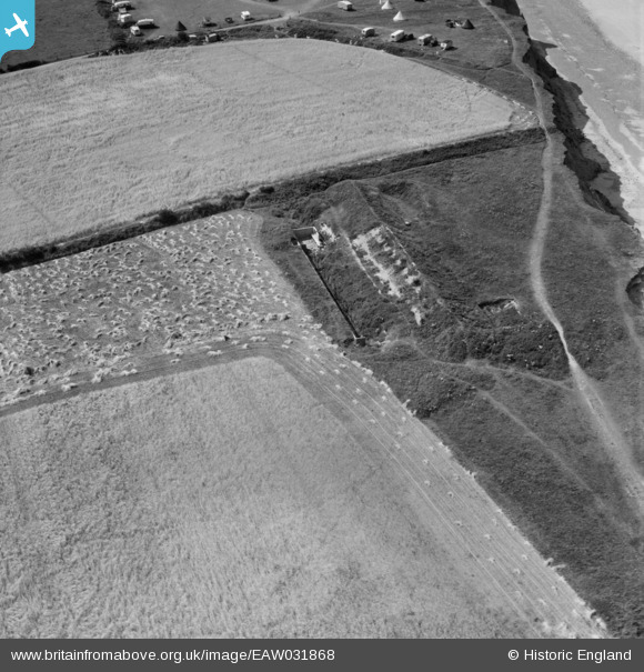
EAW031868 ENGLAND (1950). A rifle butt in the West Runton Ranges, West Runton, 1950
© Hawlfraint cyfranwyr OpenStreetMap a thrwyddedwyd gan yr OpenStreetMap Foundation. 2025. Trwyddedir y gartograffeg fel CC BY-SA.
Delweddau cyfagos (4)
EAW031868

EAW031871

EAW031870

EAW031869

Manylion
| Pennawd | [EAW031868] A rifle butt in the West Runton Ranges, West Runton, 1950 |
| Cyfeirnod | EAW031868 |
| Dyddiad | 14-August-1950 |
| Dolen | |
| Enw lle | WEST RUNTON |
| Plwyf | RUNTON |
| Ardal | |
| Gwlad | ENGLAND |
| Dwyreiniad / Gogleddiad | 618268, 343139 |
| Hydred / Lledred | 1.2487260504547, 52.940864338348 |
| Cyfeirnod Grid Cenedlaethol | TG183431 |
Pinnau

Matt Aldred edob.mattaldred.com |
Monday 11th of March 2024 03:47:40 PM |