
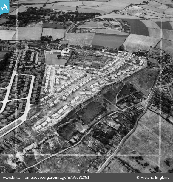
EAW031351 ENGLAND (1950). New houses along Edge Avenue, Thornhill Edge, 1950. This image was marked by Aerofilms Ltd for photo editing.
© Hawlfraint cyfranwyr OpenStreetMap a thrwyddedwyd gan yr OpenStreetMap Foundation. 2026. Trwyddedir y gartograffeg fel CC BY-SA.
Delweddau cyfagos (9)
EAW031351

EAW031349

EAW031348

EAW031345

EAW031344

EAW031347

EAW031346

EAW031350

EAW031343

Manylion
| Pennawd | [EAW031351] New houses along Edge Avenue, Thornhill Edge, 1950. This image was marked by Aerofilms Ltd for photo editing. |
| Cyfeirnod | EAW031351 |
| Dyddiad | 26-July-1950 |
| Dolen | |
| Enw lle | THORNHILL EDGE |
| Plwyf | |
| Ardal | |
| Gwlad | ENGLAND |
| Dwyreiniad / Gogleddiad | 424811, 418257 |
| Hydred / Lledred | -1.6245083089791, 53.659981719996 |
| Cyfeirnod Grid Cenedlaethol | SE248183 |
