
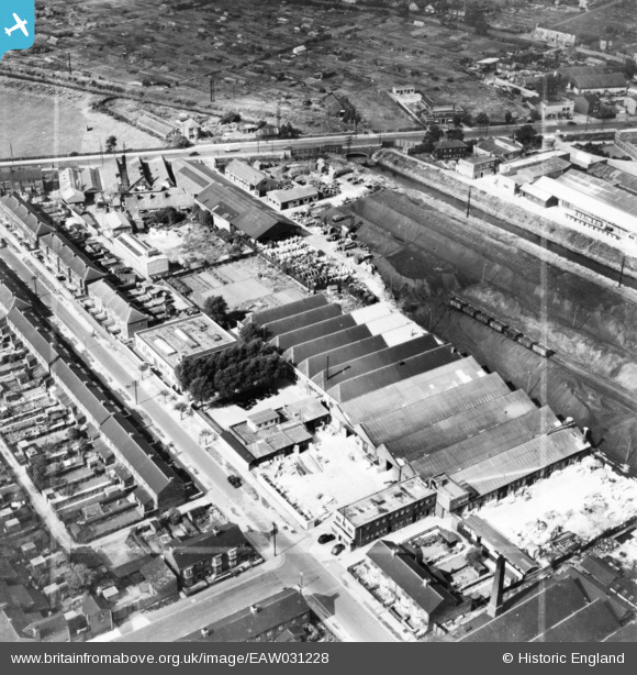
EAW031228 ENGLAND (1950). The City Engraving Co Ltd Works and environs, Kingston upon Hull, 1950. This image has been produced from a print marked by Aerofilms Ltd for photo editing.
© Hawlfraint cyfranwyr OpenStreetMap a thrwyddedwyd gan yr OpenStreetMap Foundation. 2026. Trwyddedir y gartograffeg fel CC BY-SA.
Delweddau cyfagos (11)
EAW031228

EAW031227

EAW031231

EAW031229

EAW031225

EAW031226

EAW031230

EAW031232

EPW006340

EPW006341

EPW006335

Manylion
| Pennawd | [EAW031228] The City Engraving Co Ltd Works and environs, Kingston upon Hull, 1950. This image has been produced from a print marked by Aerofilms Ltd for photo editing. |
| Cyfeirnod | EAW031228 |
| Dyddiad | 25-July-1950 |
| Dolen | |
| Enw lle | KINGSTON UPON HULL |
| Plwyf | |
| Ardal | |
| Gwlad | ENGLAND |
| Dwyreiniad / Gogleddiad | 509006, 431311 |
| Hydred / Lledred | -0.34605594265741, 53.766505469788 |
| Cyfeirnod Grid Cenedlaethol | TA090313 |
Pinnau

John Wass |
Friday 21st of November 2014 08:48:38 PM |