
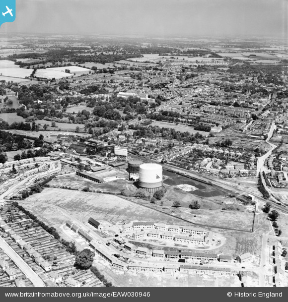
EAW030946 ENGLAND (1950). The Gas Works, construction of new housing at Pemberton Close and the city, St Albans, from the south, 1950
© Hawlfraint cyfranwyr OpenStreetMap a thrwyddedwyd gan yr OpenStreetMap Foundation. 2026. Trwyddedir y gartograffeg fel CC BY-SA.
Delweddau cyfagos (5)
EAW030946

EAW030947

EAW030237

EAW030956

EAW030950

Manylion
| Pennawd | [EAW030946] The Gas Works, construction of new housing at Pemberton Close and the city, St Albans, from the south, 1950 |
| Cyfeirnod | EAW030946 |
| Dyddiad | 13-July-1950 |
| Dolen | |
| Enw lle | ST ALBANS |
| Plwyf | |
| Ardal | |
| Gwlad | ENGLAND |
| Dwyreiniad / Gogleddiad | 514633, 205922 |
| Hydred / Lledred | -0.33958984878364, 51.739808064986 |
| Cyfeirnod Grid Cenedlaethol | TL146059 |
Pinnau
Byddwch y cyntaf i ychwanegu sylw at y ddelwedd hon!