
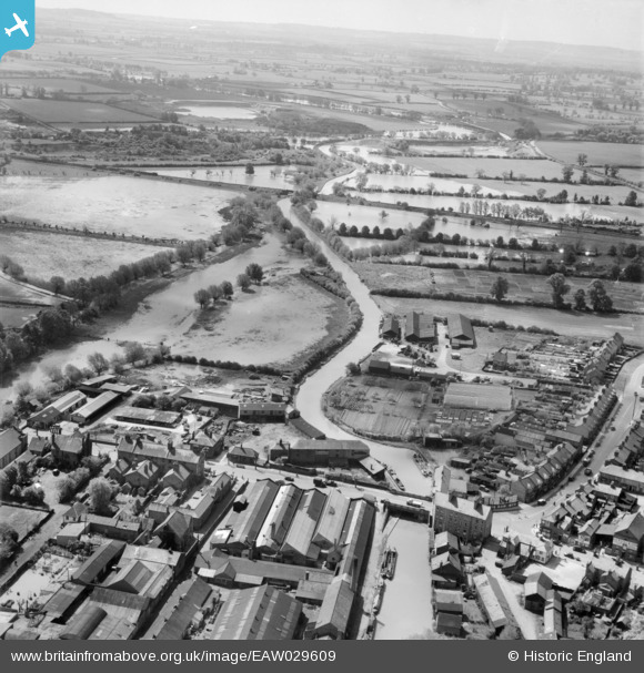
EAW029609 ENGLAND (1950). Grant's Wharf, the Grand Union Canal and flooding around the River Ouzel, Linslade, from the north, 1950
© Hawlfraint cyfranwyr OpenStreetMap a thrwyddedwyd gan yr OpenStreetMap Foundation. 2026. Trwyddedir y gartograffeg fel CC BY-SA.
Delweddau cyfagos (9)
EAW029609

EPW056944

EPW056943

EAW016586

EAW016588

EAW016584

EAW029608

EAW016585

EAW029603

Manylion
| Pennawd | [EAW029609] Grant's Wharf, the Grand Union Canal and flooding around the River Ouzel, Linslade, from the north, 1950 |
| Cyfeirnod | EAW029609 |
| Dyddiad | 22-May-1950 |
| Dolen | |
| Enw lle | LINSLADE |
| Plwyf | LEIGHTON-LINSLADE |
| Ardal | |
| Gwlad | ENGLAND |
| Dwyreiniad / Gogleddiad | 491590, 225003 |
| Hydred / Lledred | -0.66819878018359, 51.915579107274 |
| Cyfeirnod Grid Cenedlaethol | SP916250 |
