
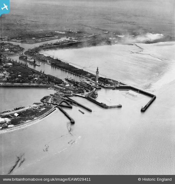
EAW029411 ENGLAND (1950). The Docks, Grimsby, from the north-east, 1950
© Hawlfraint cyfranwyr OpenStreetMap a thrwyddedwyd gan yr OpenStreetMap Foundation. 2026. Trwyddedir y gartograffeg fel CC BY-SA.
Delweddau cyfagos (9)
EAW029411

EAW029409

EAW029408

EAW029072

EAW029067

EAW029074

EAW029410

EAW029077

EAW029068

Manylion
| Pennawd | [EAW029411] The Docks, Grimsby, from the north-east, 1950 |
| Cyfeirnod | EAW029411 |
| Dyddiad | 5-April-1950 |
| Dolen | |
| Enw lle | GRIMSBY |
| Plwyf | |
| Ardal | |
| Gwlad | ENGLAND |
| Dwyreiniad / Gogleddiad | 528173, 411535 |
| Hydred / Lledred | -0.063573861536734, 53.584473659692 |
| Cyfeirnod Grid Cenedlaethol | TA282115 |
