
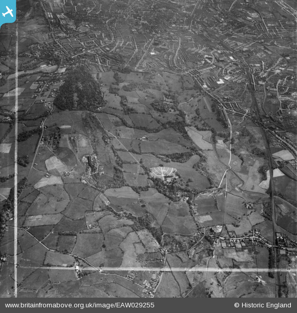
EAW029255 ENGLAND (1950). Witton Park and the town, Blackburn, 1950. This image was marked by Aerofilms Ltd for photo editing.
© Hawlfraint cyfranwyr OpenStreetMap a thrwyddedwyd gan yr OpenStreetMap Foundation. 2026. Trwyddedir y gartograffeg fel CC BY-SA.
Delweddau cyfagos (5)
EAW029255

EAW029258

EAW029256

EAW029257

EAW029259

Manylion
| Pennawd | [EAW029255] Witton Park and the town, Blackburn, 1950. This image was marked by Aerofilms Ltd for photo editing. |
| Cyfeirnod | EAW029255 |
| Dyddiad | 11-May-1950 |
| Dolen | |
| Enw lle | BLACKBURN |
| Plwyf | |
| Ardal | |
| Gwlad | ENGLAND |
| Dwyreiniad / Gogleddiad | 365359, 427410 |
| Hydred / Lledred | -2.5252772962146, 53.741697174303 |
| Cyfeirnod Grid Cenedlaethol | SD654274 |
Pinnau

ewoodeddie1968 |
Monday 26th of September 2022 06:45:58 PM | |

powerpop |
Tuesday 28th of October 2014 07:31:49 PM |