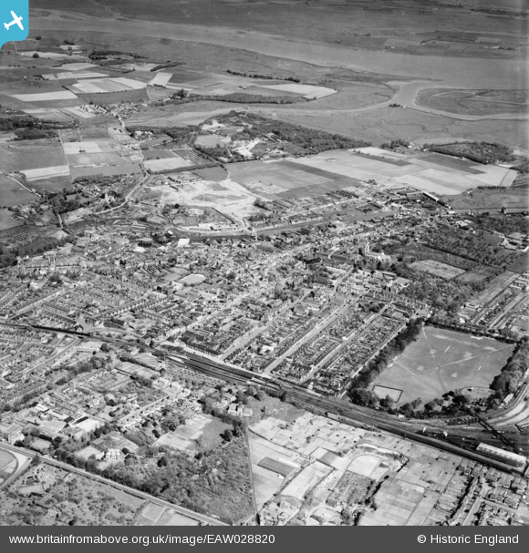
EAW028820 ENGLAND (1950). The town, Faversham, 1950
© Hawlfraint cyfranwyr OpenStreetMap a thrwyddedwyd gan yr OpenStreetMap Foundation. 2026. Trwyddedir y gartograffeg fel CC BY-SA.
Delweddau cyfagos (8)
Manylion
| Pennawd | [EAW028820] The town, Faversham, 1950 |
| Cyfeirnod | EAW028820 |
| Dyddiad | 1-May-1950 |
| Dolen | |
| Enw lle | FAVERSHAM |
| Plwyf | FAVERSHAM |
| Ardal | |
| Gwlad | ENGLAND |
| Dwyreiniad / Gogleddiad | 601585, 161423 |
| Hydred / Lledred | 0.89304066125489, 51.315643911769 |
| Cyfeirnod Grid Cenedlaethol | TR016614 |
Pinnau

Matt Aldred edob.mattaldred.com |
Thursday 8th of May 2025 03:07:29 PM | |

Stu Giles |
Tuesday 3rd of July 2018 05:51:24 PM | |

Kentishman |
Sunday 5th of February 2017 09:44:46 PM | |

Kentishman |
Sunday 5th of February 2017 09:34:29 PM | |

Kentishman |
Sunday 5th of February 2017 09:33:01 PM | |

Kentishman |
Sunday 5th of February 2017 09:11:17 PM | |

Kentishman |
Sunday 5th of February 2017 09:05:16 PM | |

Kentishman |
Sunday 5th of February 2017 08:56:25 PM | |

Kentishman |
Sunday 5th of February 2017 01:49:22 PM | |

Kentishman |
Sunday 5th of February 2017 01:42:19 PM | |

Kentishman |
Sunday 5th of February 2017 01:41:10 PM |


![[EAW028820] The town, Faversham, 1950](http://britainfromabove.org.uk/sites/all/libraries/aerofilms-images/public/100x100/EAW/028/EAW028820.jpg)
![[EPW018591] Abbey Street and the town centre, Faversham, 1927](http://britainfromabove.org.uk/sites/all/libraries/aerofilms-images/public/100x100/EPW/018/EPW018591.jpg)
![[EPW013291] The town centre, Faversham, 1925. This image has been produced from a copy-negative.](http://britainfromabove.org.uk/sites/all/libraries/aerofilms-images/public/100x100/EPW/013/EPW013291.jpg)
![[EPW018634] Stone Street and environs, Faversham, 1927](http://britainfromabove.org.uk/sites/all/libraries/aerofilms-images/public/100x100/EPW/018/EPW018634.jpg)
![[EAW028819] The railway station and town, Faversham, 1950](http://britainfromabove.org.uk/sites/all/libraries/aerofilms-images/public/100x100/EAW/028/EAW028819.jpg)
![[EPW018596] St Mary's Church and the site of St Saviour's Abbey and environs, Faversham, 1927](http://britainfromabove.org.uk/sites/all/libraries/aerofilms-images/public/100x100/EPW/018/EPW018596.jpg)
![[EPW013293] East Street and environs, Faversham, 1925. This image has been produced from a copy-negative.](http://britainfromabove.org.uk/sites/all/libraries/aerofilms-images/public/100x100/EPW/013/EPW013293.jpg)
![[EAW028818] The town, Faversham, 1950](http://britainfromabove.org.uk/sites/all/libraries/aerofilms-images/public/100x100/EAW/028/EAW028818.jpg)