
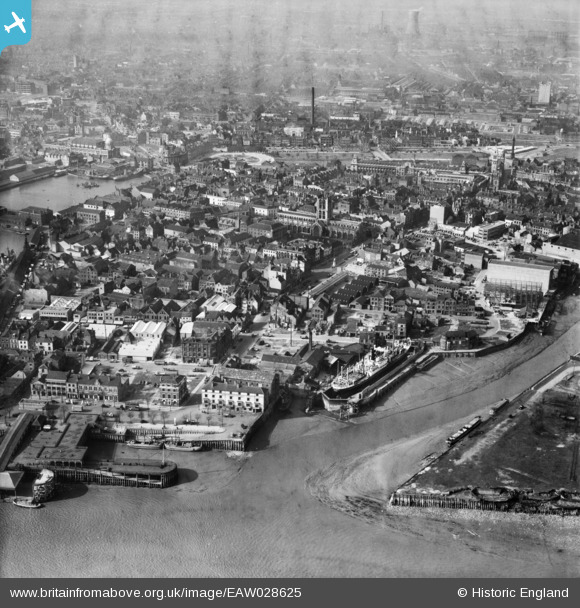
EAW028625 ENGLAND (1950). The mouth of the River Hull, Holy Trinity Church and the surrounding area, Kingston upon Hull, 1950
© Hawlfraint cyfranwyr OpenStreetMap a thrwyddedwyd gan yr OpenStreetMap Foundation. 2026. Trwyddedir y gartograffeg fel CC BY-SA.
Delweddau cyfagos (13)
EAW028625

EAW015644

EAW015638

EAW046134

EAW015645

EAW015658

EAW046136

EPW010789

EAW046145

EPW036413

EAW028626

EPW036382

EAW046146

Manylion
| Pennawd | [EAW028625] The mouth of the River Hull, Holy Trinity Church and the surrounding area, Kingston upon Hull, 1950 |
| Cyfeirnod | EAW028625 |
| Dyddiad | 5-April-1950 |
| Dolen | |
| Enw lle | KINGSTON UPON HULL |
| Plwyf | |
| Ardal | |
| Gwlad | ENGLAND |
| Dwyreiniad / Gogleddiad | 509997, 428393 |
| Hydred / Lledred | -0.33206578362195, 53.740078128908 |
| Cyfeirnod Grid Cenedlaethol | TA100284 |
