
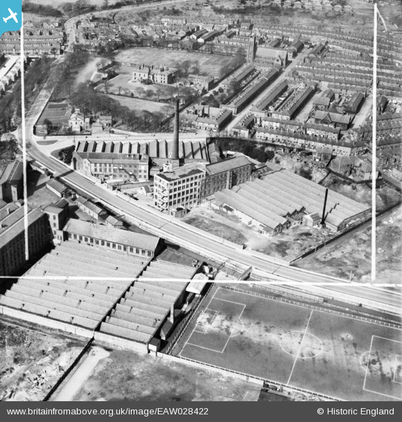
EAW028422 ENGLAND (1950). Witton Mill, Stancliffe Mill, Griffin Mill and environs, Blackburn, 1950. This image was marked by Aerofilms Ltd for photo editing.
© Hawlfraint cyfranwyr OpenStreetMap a thrwyddedwyd gan yr OpenStreetMap Foundation. 2026. Trwyddedir y gartograffeg fel CC BY-SA.
Delweddau cyfagos (10)
EAW028422

EAW028426

EAW028420

EAW028421

EPW013923

EAW028419

EAW028424

EAW028427

EAW028423

EAW028425

Manylion
| Pennawd | [EAW028422] Witton Mill, Stancliffe Mill, Griffin Mill and environs, Blackburn, 1950. This image was marked by Aerofilms Ltd for photo editing. |
| Cyfeirnod | EAW028422 |
| Dyddiad | 24-March-1950 |
| Dolen | |
| Enw lle | BLACKBURN |
| Plwyf | |
| Ardal | |
| Gwlad | ENGLAND |
| Dwyreiniad / Gogleddiad | 367066, 427079 |
| Hydred / Lledred | -2.4993591141478, 53.738832533475 |
| Cyfeirnod Grid Cenedlaethol | SD671271 |
