
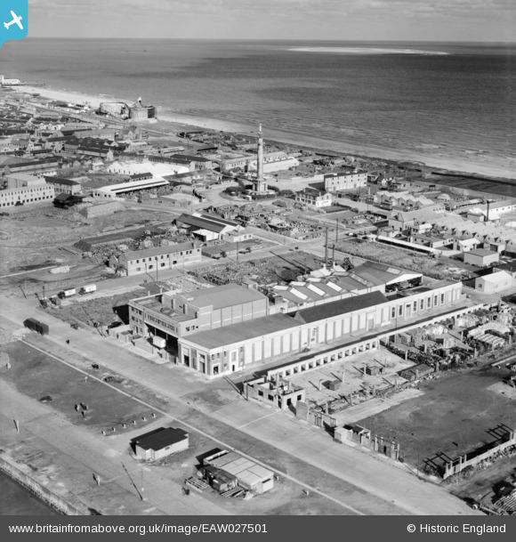
EAW027501 ENGLAND (1949). The Birds Eye Foods Ltd Canning Factory on South Denes Road, Great Yarmouth, from the south-west, 1949
© Hawlfraint cyfranwyr OpenStreetMap a thrwyddedwyd gan yr OpenStreetMap Foundation. 2026. Trwyddedir y gartograffeg fel CC BY-SA.
Delweddau cyfagos (30)
EAW027501

EAW047613

EAW047609

EAW047615

EAW047614

EAW027509

EAW047611

EAW027508

EAW027505

EAW027506

EAW027507

EAW027502

EAW027504

EAW047608

EAW047612

EAW047616

EAW047610

EAW027503

EAW027510

EAW008169

EAW008164

EAW008165

EAW008170

EAW008162

EAW008160

EAW008161

EAW008159

EAW008163

EAW008171

EAW008167

Manylion
| Pennawd | [EAW027501] The Birds Eye Foods Ltd Canning Factory on South Denes Road, Great Yarmouth, from the south-west, 1949 |
| Cyfeirnod | EAW027501 |
| Dyddiad | 31-October-1949 |
| Dolen | |
| Enw lle | GREAT YARMOUTH |
| Plwyf | |
| Ardal | |
| Gwlad | ENGLAND |
| Dwyreiniad / Gogleddiad | 652849, 305275 |
| Hydred / Lledred | 1.7331091853043, 52.586004846737 |
| Cyfeirnod Grid Cenedlaethol | TG528053 |

