
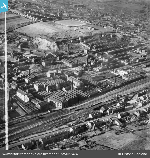
EAW027474 ENGLAND (1949). Woollen Mills surrounding Bradford Road East and the Batley Cricket, Athletic and Football Grounds, Batley, 1949. This image was marked by Aerofilms Ltd for photo editing.
© Hawlfraint cyfranwyr OpenStreetMap a thrwyddedwyd gan yr OpenStreetMap Foundation. 2026. Trwyddedir y gartograffeg fel CC BY-SA.
Delweddau cyfagos (12)
EAW027474

EAW027480

EAW027483

EAW027473

EAW027479

EAW027475

EAW027481

EAW027477

EAW027478

EAW027476

EAW027482

EAW027472

Manylion
| Pennawd | [EAW027474] Woollen Mills surrounding Bradford Road East and the Batley Cricket, Athletic and Football Grounds, Batley, 1949. This image was marked by Aerofilms Ltd for photo editing. |
| Cyfeirnod | EAW027474 |
| Dyddiad | 27-October-1949 |
| Dolen | |
| Enw lle | BATLEY |
| Plwyf | |
| Ardal | |
| Gwlad | ENGLAND |
| Dwyreiniad / Gogleddiad | 424535, 423024 |
| Hydred / Lledred | -1.6283081234509, 53.702845303756 |
| Cyfeirnod Grid Cenedlaethol | SE245230 |
Pinnau

trevpau |
Friday 6th of January 2023 07:40:18 PM | |
|
HOLMES |
Tuesday 29th of September 2015 12:53:09 PM | |
|
HOLMES |
Tuesday 29th of September 2015 12:51:39 PM | |
|
gerry-r |
Thursday 1st of January 2015 10:03:45 PM |