
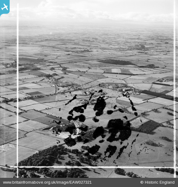
EAW027321 ENGLAND (1949). The Brenkley Opencast Coal Mining Site, Brenkley, from the north-east, 1949. This image has been produced from a damaged negative.
© Hawlfraint cyfranwyr OpenStreetMap a thrwyddedwyd gan yr OpenStreetMap Foundation. 2026. Trwyddedir y gartograffeg fel CC BY-SA.
Delweddau cyfagos (2)
EAW027321

EAW027329

Manylion
| Pennawd | [EAW027321] The Brenkley Opencast Coal Mining Site, Brenkley, from the north-east, 1949. This image has been produced from a damaged negative. |
| Cyfeirnod | EAW027321 |
| Dyddiad | 21-October-1949 |
| Dolen | |
| Enw lle | BRENKLEY |
| Plwyf | DINNINGTON |
| Ardal | |
| Gwlad | ENGLAND |
| Dwyreiniad / Gogleddiad | 421909, 576070 |
| Hydred / Lledred | -1.6567989667596, 55.078535056625 |
| Cyfeirnod Grid Cenedlaethol | NZ219761 |
Pinnau

Darwinawardee |
Tuesday 5th of May 2020 07:41:40 PM | |
|
Darwinawardee |
Tuesday 5th of May 2020 07:40:38 PM | |
|
Darwinawardee |
Tuesday 5th of May 2020 07:37:59 PM | |
|
Darwinawardee |
Tuesday 5th of May 2020 07:37:07 PM | |
|
Darwinawardee |
Tuesday 5th of May 2020 07:33:53 PM | |
|
Darwinawardee |
Tuesday 5th of May 2020 07:33:36 PM |