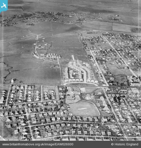
EAW026930 ENGLAND (1949). Thameside Crescent, Long Road and the surrounding residential area, Canvey Island, 1949
© Hawlfraint cyfranwyr OpenStreetMap a thrwyddedwyd gan yr OpenStreetMap Foundation. 2026. Trwyddedir y gartograffeg fel CC BY-SA.
Manylion
| Pennawd | [EAW026930] Thameside Crescent, Long Road and the surrounding residential area, Canvey Island, 1949 |
| Cyfeirnod | EAW026930 |
| Dyddiad | 2-October-1949 |
| Dolen | |
| Enw lle | CANVEY ISLAND |
| Plwyf | CANVEY ISLAND |
| Ardal | |
| Gwlad | ENGLAND |
| Dwyreiniad / Gogleddiad | 578975, 183414 |
| Hydred / Lledred | 0.58003330921575, 51.520763735291 |
| Cyfeirnod Grid Cenedlaethol | TQ790834 |
Pinnau

redmist |
Wednesday 1st of February 2023 11:29:01 PM |


![[EAW026930] Thameside Crescent, Long Road and the surrounding residential area, Canvey Island, 1949](http://britainfromabove.org.uk/sites/all/libraries/aerofilms-images/public/100x100/EAW/026/EAW026930.jpg)
![[EAW045332] The town, Canvey Island, 1952](http://britainfromabove.org.uk/sites/all/libraries/aerofilms-images/public/100x100/EAW/045/EAW045332.jpg)
![[EAW045310] Thameside Crescent and housing around Long Road, Canvey Island, 1952](http://britainfromabove.org.uk/sites/all/libraries/aerofilms-images/public/100x100/EAW/045/EAW045310.jpg)
![[EAW045311] The Catholic Church of our Lady and the English Martyrs and surrounding fields and housing off Long Road, Canvey Island, 1952](http://britainfromabove.org.uk/sites/all/libraries/aerofilms-images/public/100x100/EAW/045/EAW045311.jpg)