
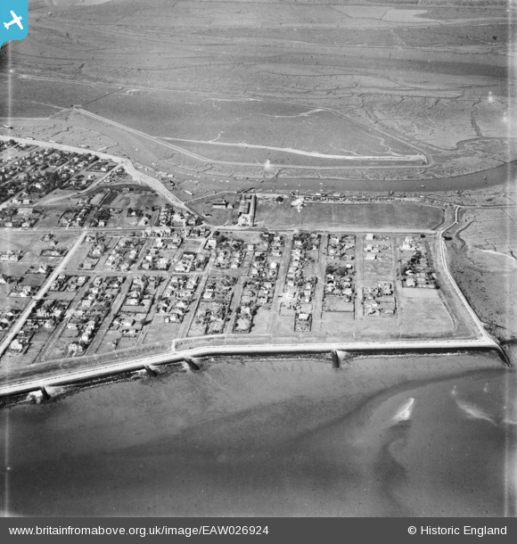
EAW026924 ENGLAND (1949). Marine Parade, Zelhem Drive and the surrounding residential area, Canvey Island, 1949
© Hawlfraint cyfranwyr OpenStreetMap a thrwyddedwyd gan yr OpenStreetMap Foundation. 2026. Trwyddedir y gartograffeg fel CC BY-SA.
Delweddau cyfagos (2)
EAW026924

EAW026922

Manylion
| Pennawd | [EAW026924] Marine Parade, Zelhem Drive and the surrounding residential area, Canvey Island, 1949 |
| Cyfeirnod | EAW026924 |
| Dyddiad | 2-October-1949 |
| Dolen | |
| Enw lle | CANVEY ISLAND |
| Plwyf | CANVEY ISLAND |
| Ardal | |
| Gwlad | ENGLAND |
| Dwyreiniad / Gogleddiad | 581944, 183151 |
| Hydred / Lledred | 0.62264961021893, 51.517452570726 |
| Cyfeirnod Grid Cenedlaethol | TQ819832 |
Pinnau

Linden lea |
Tuesday 21st of June 2016 06:45:13 AM | |
|
cptpies |
Thursday 17th of December 2015 04:02:53 PM | |
|
cptpies |
Thursday 17th of December 2015 04:02:18 PM |
Cyfraniadau Grŵp

Pillboxes on the sea wall, Canvey Island. |
cptpies |
Thursday 17th of December 2015 04:03:49 PM |