
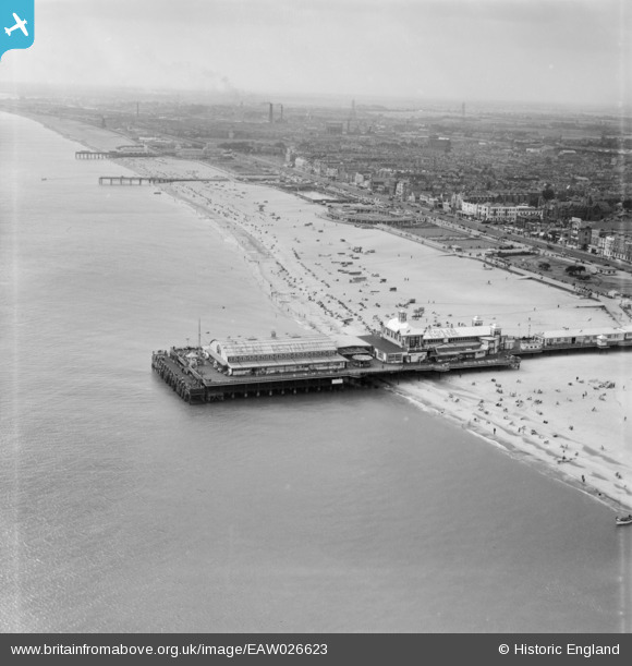
EAW026623 ENGLAND (1949). Britannia Pier and the beach, Great Yarmouth, from the north-east, 1949
© Hawlfraint cyfranwyr OpenStreetMap a thrwyddedwyd gan yr OpenStreetMap Foundation. 2026. Trwyddedir y gartograffeg fel CC BY-SA.
Delweddau cyfagos (11)
EAW026623

EAW045609

EAW045607

EAW005071

EPW021186

EAW005072

EAW045614

EAW026625

EAW026624

EPW021196

EAW045612

Manylion
| Pennawd | [EAW026623] Britannia Pier and the beach, Great Yarmouth, from the north-east, 1949 |
| Cyfeirnod | EAW026623 |
| Dyddiad | 16-September-1949 |
| Dolen | |
| Enw lle | GREAT YARMOUTH |
| Plwyf | |
| Ardal | |
| Gwlad | ENGLAND |
| Dwyreiniad / Gogleddiad | 653375, 307797 |
| Hydred / Lledred | 1.7427876488611, 52.608386519289 |
| Cyfeirnod Grid Cenedlaethol | TG534078 |
Pinnau

bugbear |
Tuesday 17th of August 2021 05:19:31 PM | |
|
bugbear |
Tuesday 17th of August 2021 05:18:28 PM | |
|
bugbear |
Tuesday 17th of August 2021 05:18:12 PM | |
|
bugbear |
Tuesday 17th of August 2021 05:17:50 PM | |

Alan McFaden |
Sunday 31st of August 2014 10:57:59 AM | |
|
Alan McFaden |
Sunday 31st of August 2014 10:57:17 AM |


Cyfraniadau Grŵp
Its now possible to walk around the end of the pier at low tide . The beach has made up so much. |
pebble |
Tuesday 18th of February 2014 12:12:24 PM |