
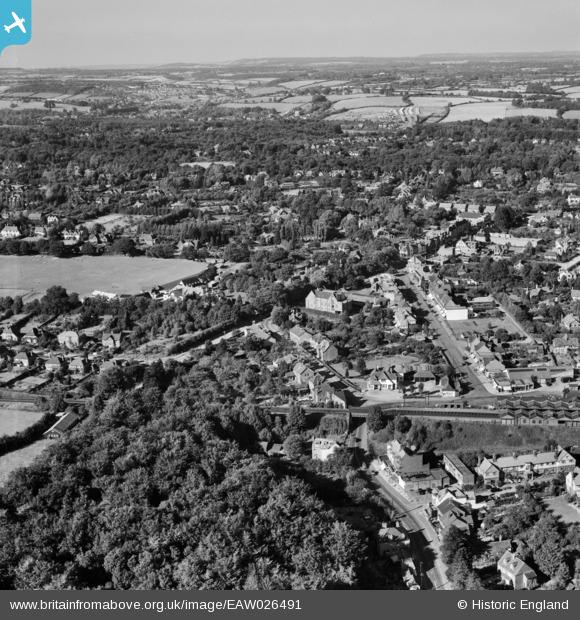
EAW026491 ENGLAND (1949). Station Road, Hill Avenue and environs, Amersham, from the south, 1949
© Hawlfraint cyfranwyr OpenStreetMap a thrwyddedwyd gan yr OpenStreetMap Foundation. 2026. Trwyddedir y gartograffeg fel CC BY-SA.
Delweddau cyfagos (3)
EAW026491

EAW026490

EPW017832

Manylion
| Pennawd | [EAW026491] Station Road, Hill Avenue and environs, Amersham, from the south, 1949 |
| Cyfeirnod | EAW026491 |
| Dyddiad | 10-September-1949 |
| Dolen | |
| Enw lle | AMERSHAM |
| Plwyf | AMERSHAM |
| Ardal | |
| Gwlad | ENGLAND |
| Dwyreiniad / Gogleddiad | 496273, 198205 |
| Hydred / Lledred | -0.60756554814653, 51.673891591661 |
| Cyfeirnod Grid Cenedlaethol | SU963982 |
