
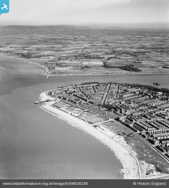
EAW026238 ENGLAND (1949). The Mount, the mouth of the River Wyre and the town, Fleetwood, from the west, 1949
© Hawlfraint cyfranwyr OpenStreetMap a thrwyddedwyd gan yr OpenStreetMap Foundation. 2026. Trwyddedir y gartograffeg fel CC BY-SA.
Delweddau cyfagos (5)
EAW026238

EAW023416

EPW003043

EPW003046

EPW003045

Manylion
| Pennawd | [EAW026238] The Mount, the mouth of the River Wyre and the town, Fleetwood, from the west, 1949 |
| Cyfeirnod | EAW026238 |
| Dyddiad | 15-August-1949 |
| Dolen | |
| Enw lle | FLEETWOOD |
| Plwyf | FLEETWOOD |
| Ardal | |
| Gwlad | ENGLAND |
| Dwyreiniad / Gogleddiad | 333087, 448337 |
| Hydred / Lledred | -3.0191242993546, 53.926636284186 |
| Cyfeirnod Grid Cenedlaethol | SD331483 |
Pinnau

redmist |
Wednesday 10th of February 2021 08:03:33 PM | |
|
redmist |
Wednesday 10th of February 2021 08:00:58 PM | |
|
John Wass |
Wednesday 29th of April 2015 09:32:20 PM | |
|
wadey |
Tuesday 7th of October 2014 01:02:02 PM |