
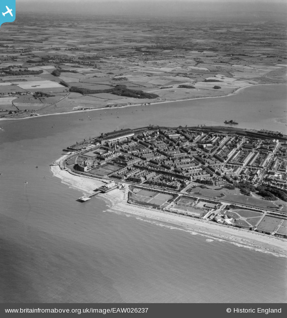
EAW026237 ENGLAND (1949). Fleetwood Pier, the mouth of the River Wyre and the town, Fleetwood, from the north-west, 1949
© Hawlfraint cyfranwyr OpenStreetMap a thrwyddedwyd gan yr OpenStreetMap Foundation. 2026. Trwyddedir y gartograffeg fel CC BY-SA.
Delweddau cyfagos (6)
EAW026237

EAW023415

EPW038912

EPW003040

EPW014343

EPW003043

Manylion
| Pennawd | [EAW026237] Fleetwood Pier, the mouth of the River Wyre and the town, Fleetwood, from the north-west, 1949 |
| Cyfeirnod | EAW026237 |
| Dyddiad | 15-August-1949 |
| Dolen | |
| Enw lle | FLEETWOOD |
| Plwyf | FLEETWOOD |
| Ardal | |
| Gwlad | ENGLAND |
| Dwyreiniad / Gogleddiad | 333449, 448482 |
| Hydred / Lledred | -3.0136433579571, 53.927986110772 |
| Cyfeirnod Grid Cenedlaethol | SD334485 |
