
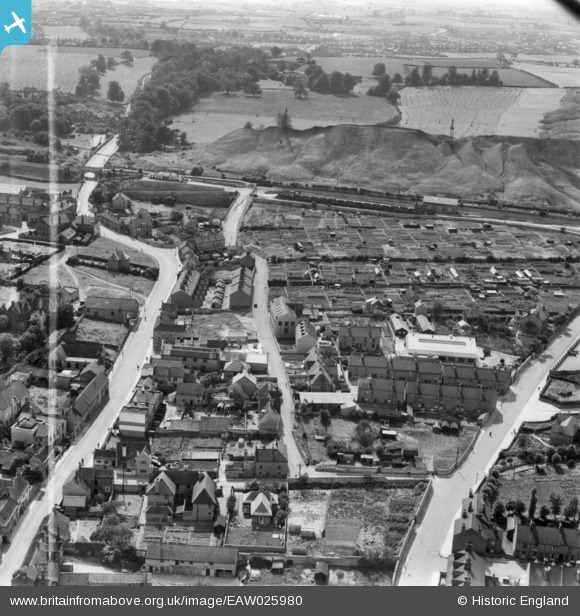
EAW025980 ENGLAND (1949). Grove Street and environs, Mansfield Woodhouse, 1949. This image has been produced from a print marked by Aerofilms Ltd for photo editing.
© Hawlfraint cyfranwyr OpenStreetMap a thrwyddedwyd gan yr OpenStreetMap Foundation. 2026. Trwyddedir y gartograffeg fel CC BY-SA.
Delweddau cyfagos (7)
EAW025980

EAW025978

EAW025979

EAW025975

EAW025977

EAW025976

EAW025981

Manylion
| Pennawd | [EAW025980] Grove Street and environs, Mansfield Woodhouse, 1949. This image has been produced from a print marked by Aerofilms Ltd for photo editing. |
| Cyfeirnod | EAW025980 |
| Dyddiad | 13-August-1949 |
| Dolen | |
| Enw lle | MANSFIELD WOODHOUSE |
| Plwyf | |
| Ardal | |
| Gwlad | ENGLAND |
| Dwyreiniad / Gogleddiad | 453669, 363267 |
| Hydred / Lledred | -1.1971665378718, 53.163527233299 |
| Cyfeirnod Grid Cenedlaethol | SK537633 |
