
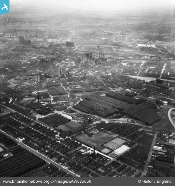
EAW025659 ENGLAND (1949). The English Steel Corporation North Street Works, Openshaw, from the south-east, 1949. This image has been produced from a print.
© Hawlfraint cyfranwyr OpenStreetMap a thrwyddedwyd gan yr OpenStreetMap Foundation. 2026. Trwyddedir y gartograffeg fel CC BY-SA.
Delweddau cyfagos (7)
EAW025659

EAW022089

EAW025661

EAW022085

EAW022087

EAW022086

EAW022083

Manylion
| Pennawd | [EAW025659] The English Steel Corporation North Street Works, Openshaw, from the south-east, 1949. This image has been produced from a print. |
| Cyfeirnod | EAW025659 |
| Dyddiad | 1-August-1949 |
| Dolen | |
| Enw lle | OPENSHAW |
| Plwyf | |
| Ardal | |
| Gwlad | ENGLAND |
| Dwyreiniad / Gogleddiad | 388134, 397595 |
| Hydred / Lledred | -2.1787975398637, 53.474698518713 |
| Cyfeirnod Grid Cenedlaethol | SJ881976 |
Pinnau

papacho |
Monday 3rd of April 2023 12:07:43 AM | |
|
Barney Rubble |
Sunday 22nd of April 2018 06:50:45 PM | |
|
Barney Rubble |
Sunday 22nd of April 2018 06:47:07 PM | |
|
Barney Rubble |
Sunday 22nd of April 2018 06:45:47 PM | |
|
I.Johnson |
Wednesday 5th of November 2014 07:37:22 PM | |
|
I.Johnson |
Wednesday 5th of November 2014 07:35:50 PM |