
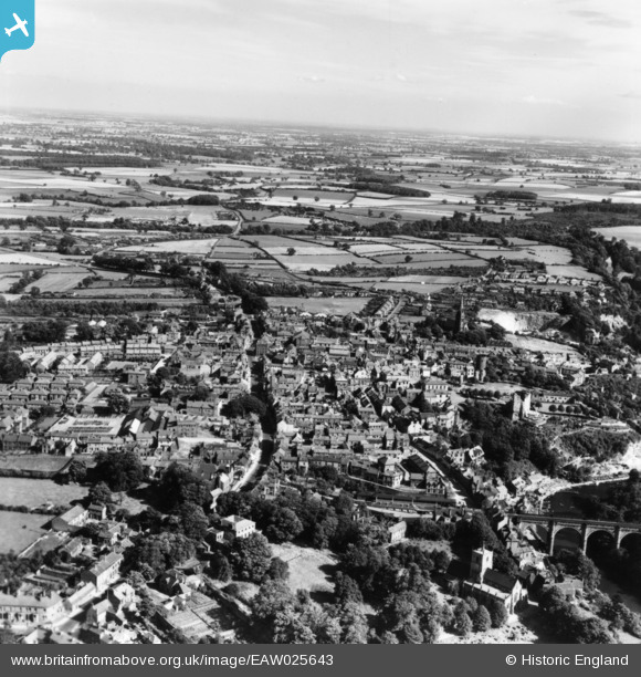
EAW025643 ENGLAND (1949). The town, Knaresborough, from the north-west, 1949. This image has been produced from a print.
© Hawlfraint cyfranwyr OpenStreetMap a thrwyddedwyd gan yr OpenStreetMap Foundation. 2026. Trwyddedir y gartograffeg fel CC BY-SA.
Delweddau cyfagos (10)
EAW025643

EAW025641

EPW015831

EAW025646

EAW025644

EPW015827

EAW025642

EAW025647

EPW015830

EAW025645

Manylion
| Pennawd | [EAW025643] The town, Knaresborough, from the north-west, 1949. This image has been produced from a print. |
| Cyfeirnod | EAW025643 |
| Dyddiad | 3-August-1949 |
| Dolen | |
| Enw lle | KNARESBOROUGH |
| Plwyf | KNARESBOROUGH |
| Ardal | |
| Gwlad | ENGLAND |
| Dwyreiniad / Gogleddiad | 434846, 457141 |
| Hydred / Lledred | -1.4682347361094, 54.008920960877 |
| Cyfeirnod Grid Cenedlaethol | SE348571 |
Pinnau
Byddwch y cyntaf i ychwanegu sylw at y ddelwedd hon!